North Carolina COHAZ Decision Portal Conveys Critical Data and Useful Mapping Products
- Detalles
- Publicado: 07 Marzo 2012 07 Marzo 2012
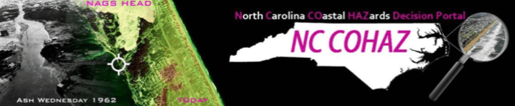
At left is a montage of coastal hazard images which is explained on the web site: http://www.coastal.geology.ecu.edu/NCCOHAZ/
J.P. Walsh1,2, Reide Corbett1,2 and Tom Allen1
1- East Carolina Univesity
2- UNC Coastal Studies Institute
The coast of North Carolina is at risk to a diversity of hazards (e.g., storm surge, sea-level rise), and these hazards potentially can have major consequences (financial and otherwise) for people who live, work, and recreate in impacted areas. There has been much research conducted on coastal hazards affecting North Carolina and their ramification, but information is scattered and often hard to track down. Also, it is typically not in a form suitable for public consumption. To improve on these issues, a team of researchers from the departments of Geological Sciences and Geography at East Carolina University (ECU) has worked with others at ECU and around the state to develop a web-based information site on coastal hazards and related research; it is called the North Carolina COastal HAZards (NC COHAZ) Decision Portal. At the site (http://www.coastal.geology.ecu.edu/NCCOHAZ/), a variety of information on coastal hazards in the state (particularly the northeastern portion) has been coalesced.
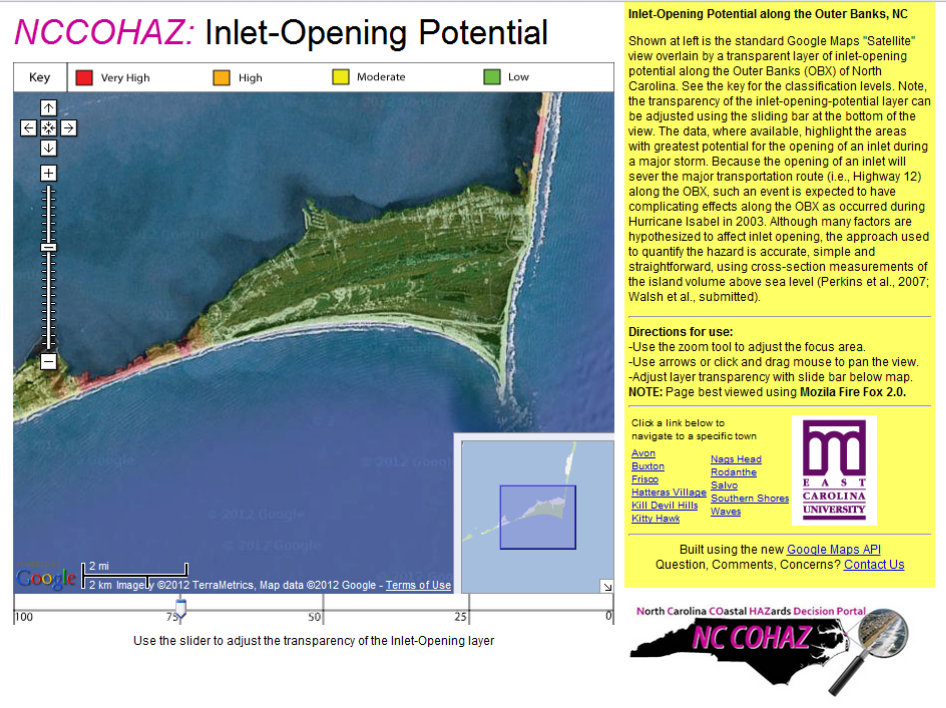
Visitors to the web portal are welcomed by a colorful banner at the top of the web page (Figure 1). On the main entrance page, “news bytes” are regularly updated using an integrated blog; these short pieces communicate interesting hazard-related stories or information and usually feature a photograph, map or video. The “Maps and Visualizations” page provides links to a variety of tools and products on topics such as current hazards, shoreline erosion and inlet-opening potential (Figure 2). Several user-friendly mapping tools have been created to allow researchers, managers and the public to explore maps of immediate or potential hazards (e.g., sites of flooding, strong winds, large waves). The approach used for presentation and validity of some of the tools can be argued (e.g., erosion projections). Nevertheless, the creators believe it is better to have this information out and available where it can be considered, rather than hidden in hard-to-find journals or difficult-to-obtain reports.
Please take some time to visit the NC COHAZ Decision Portal. The developers have a variety of ideas on how to expand the site, such as plans for a more formal marine atlas. But, if you have any suggestions or thoughts on information contained on the site or data you would like to see added, etc., do not hesitate to contact J.P. Walsh, Esta dirección de correo electrónico está siendo protegida contra los robots de spam. Necesita tener JavaScript habilitado para poder verlo., (252) 328-5431. Feedback of any kind is appreciated. Hopefully, this site will improve communication and information on coastal data exchange around the state and beyond. Ultimately, the goal of NC COHAZ is to help mitigate the effects of coastal hazards on the citizens of North Carolina, and this can only be accomplished through better sharing of knowledge, data and ideas.