Red

La membresía de ICAN está abierta a todas las partes interesadas que aceptan la misión y los objetivos de ICAN, incluidos aquellos que tienen un Atlas web costero operativo, así como aquellos que esperan diseñar y construir un Atlas web.

Internacional

ICAN es un proyecto del Programa IODE de la COI de la UNESCO, y los miembros de ICAN buscan desempeñar un papel de liderazgo en la creación de colaboraciones internacionales de valor para las naciones participantes, optimizando así la gobernanza regional en la gestión de zonas costeras y la planificación espacial marina.

Atlas

Los atlas son "...colecciones de mapas digitales y conjuntos de datos con tablas complementarias, ilustraciones e información que ilustran sistemáticamente la costa, a menudo con herramientas cartográficas y de apoyo a la toma de decisiones, todas las cuales son accesibles a través de Internet.."  O'Dea et al., 2007

Costeros

Vivimos en un planeta azul, con océanos y mares que cubren más del 70% de la superficie de la Tierra. Los océanos nos alimentan, regulan nuestro clima y generan la mayor parte del oxígeno que respiramos. Aproximadamente el 37% de la población mundial vive a menos de 100 km de la costa. (UNEP)

¡Únete a nosotros!

www.coinatlantic.ca

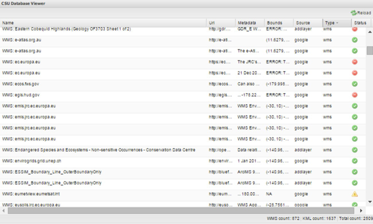
COINAtlantic has introduced a local database viewer to its Search Utility (CSU) web-based application. Each result of a user’s search for WMS and KML resources using the Google Custom Search API or a user’s addition of a WMS layer using the “Add WMS Layer” widget is stored in a local PostSQL data base. A script has been developed to interrogate each of the resources on a daily basis and store the geographic bounds of the KML or the WMS layer. If the interrogation successfully returns the geographic bounds, a green status symbol is displayed in the CSU database viewer (see below). If the interrogation was successful but the bounds were not returned a yellow symbol is returned. A red symbol is displayed if the service did not respond. This capability is a precursor development to support reliability indicators displayed in the CSU user interface and will enable geographic searches of the local data base.

A screen shot of the CSU Database Viewer showing name, URL, Abstract, geographic bounds, whether the resources was added through a Google search or by the manual addition of a layer, the resource type (WMS or KML) and its status at the time of the latest interrogation.

Para nuestras Costas

Vol, 8, Nr 2 - Now Available!

We are now entering our 9th year publishing the ICAN newsletter. Many thanks to our Editor Andy Sherin!

Please consider preparing an article for the next newsletter that will likely be published in the spring of this year.

Happy New Year!

Photos from CoastGIS 2018

Our friends from CoastGIS 2018 have posted a wonderful gallery of photos, including the recent ICAN mini-workshop:

See how many ICAN members you can spot!