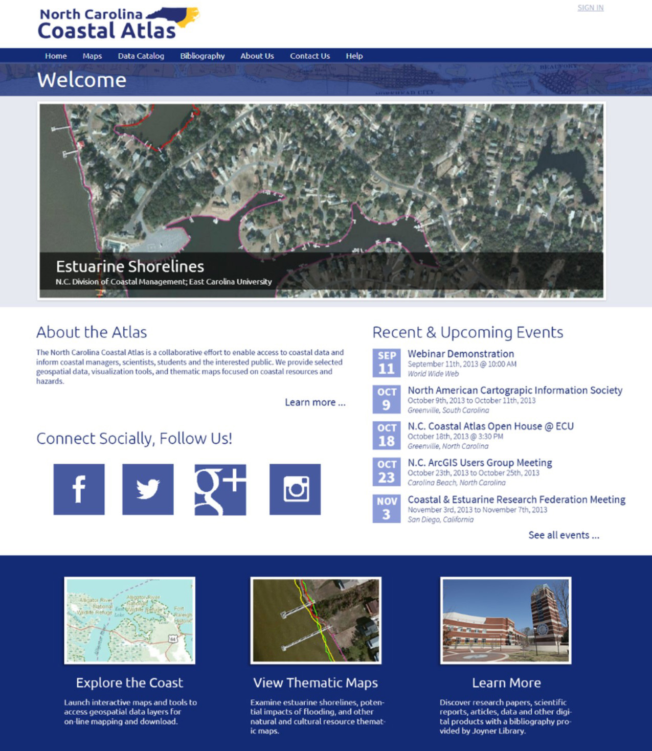
Introducing the North Carolina Coastal Atlas
- Details
- Published: 05 September 2013 05 September 2013
Michelle Covi
East Carolina University
This email address is being protected from spambots. You need JavaScript enabled to view it.
The North Carolina Coastal Atlas http://www.nccoastalatlas.org/ had its genesis when several East Carolina University researchers and state agency coastal managers came together to address some important coastal issues. Although North Carolina has a large amount of coastal resource data, it is located in many different agencies, universities and other organizations in a way that is not coordinated or integrated. The North Carolina Coastal Atlas provides users with a geospatial portal that will allow various data to be displayed, combined, analyzed and ultimately shared. With an emphasis on thematic maps which highlight data useful for specific user needs and a unique geo-referenced bibliographic search function, the North Carolina Coastal Atlas avoids duplication of services available on regional portals or through state agency services.
Thematic Maps
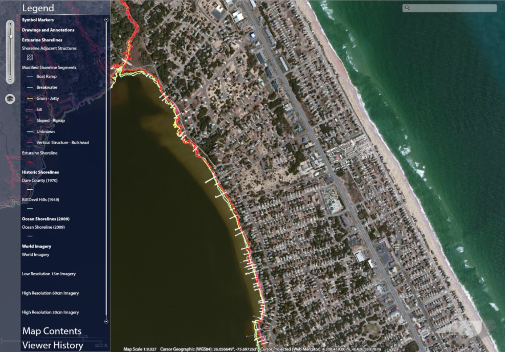
In 2012, the North Carolina Division of Coastal Management completed their first-ever continuous digital map of the estuarine shoreline in the state, mapping over 12,000 miles. The Estuarine and Ocean Shoreline thematic map located on the North Carolina Coastal Atlas provides access to this data with a custom viewer. Shorelines were delineated using heads-up digitizing from geo-referenced county-level aerial orthophotographs at a viewing extent of 1:300-1:500. Shoreline-adjacent structures were also inventoried, digitized, and attributed and are available within the atlas, including boat ramps, docks, breakwaters, groins, sills, riprap, and bulkheads. Coastal managers identified a potential use for shoreline and associated data within the atlas as a way to facilitate the permit application and review processes for coastal property owners. Users can identify their building site within the context of adjacent development and natural systems including wetlands and submerged aquatic vegetation. In the near future, the atlas user interface will allow the public to create a sketch of their building plan, showing all neighboring properties, water bodies, and required buffers. Once completed, sketches can be shared via URL or social networking sites. The permitting process can thus be streamlined and made clearer when both those requesting permits and those reviewing permits have access to the same information. The North Carolina Coastal atlas promises to facilitate such important, spatially-referenced communication.
The Wetland, Habitats and Threats thematic map focuses on the wetland management use case. The North Carolina coastal region has extensive and diverse wetland types given its low elevation lands with poor drainage and warm temperate climate. Wetlands play an important role in reducing water pollution, flood mitigation and habitat for wildlife, including nursery areas for important seafood species. Managers planning for wetlands protection or restoration need tools to help visualize both priority wetlands and potential threats to wetland stability or survival. The map uses the North Carolina Coastal Region Evaluation of Wetland Significance (NC-CREWS), a watershed-based wetlands functional assessment model, to categorize wetlands by significance. Threats visualized include coastal near-shore structures and the potential threat of sea-level rise, modeled using the Sea Level Rise Affecting Marshes Model (SLAMM) and the Marsh Equilibrium Model (MEMII). Future data layers will illustrate other potential threats to wetland habitat such as land use change and the locations of stream obstructions or water withdrawals.
The Flood Inundation Vulnerability map examines potential flooding of coastal communities and demonstrates the utility of maps to identify risk to coastal natural resources and selected municipal areas. In North Carolina, riverine flooding, urban flash floods, storm surges, and potential sea-level rise combine to increase flood hazard risk, especially in low elevation coastal flood zones. These maps combine flood zone data provided by North Carolina Emergency Management with local critical infrastructure data. Municipal water infrastructure such as fresh water intakes, municipal wells, pump and transfer stations, wastewater treatment plants and outfalls are frequently located at low elevation sites to use gravity to move water in the system whenever possible. Supply system infrastructure such as electric utilities, transportation and communication are critically important and also vulnerable to inundation in low elevation areas.
Bibliographic Reference Integration
The North Carolina Coastal Atlas integrates geotagged bibliographic information as a unique coastal atlas feature, which allows coastal researchers and managers to easily assemble geographically-limited literature reviews. The faceted search engine built upon Apache Solr allows type, time range, author and keyword searches. Bibliographic references are synchronized with Mendeley reference management software to assist users in organizing and sharing their custom bibliographies.
Collaboration
The North Carolina Coastal Atlas is produced by a team committed to sharing and promoting the use of coastal geospatial data and technology for education, broad public use and decision-making. The Atlas project is managed by a steering committee providing overall governance, standards and procedures, and data stewardship. The steering committee determines the design, data, and tools to offer end users, and is committed to the use of best practices for data management and accessibility for the public good. The Atlas is supported by grants and contracts from stakeholders and in-kind contributions from the North Carolina Division of Coastal Management (DCM), NOAA Center for Sponsored Coastal Ocean Research (CSCOR) and Cooperative Institute for Climate and Satellites (CICS), North Carolina Sea Grant, ECU Center for Coastal Informatics and Modeling (C-SIM), ECU Academic Library Services, ECU Center for GIScience, and UNC Coastal Studies Institute. Also participating in the collaboration are the Albemarle Pamlico National Estuary Partnership, North Carolina Division of Emergency Management, North Carolina Division of Marine Fisheries, and the North Carolina Center for Geographic Information and Analysis.
Adaptive Participatory Management
The North Carolina Coastal Atlas is taking an intentionally user-oriented approach to developing thematic maps and other content. Before developing content, a needs assessment was conducted with potential users including planners, resource managers, engineers and other interested coastal managers. Essential data categories and useful tools were identified and targeted for incorporation into the digital atlas. As these data and tools continue to be developed, usability and user needs will guide decisions and priority setting. One future direction is public participatory maps which integrate knowledge from both experts and other people living at the coast. These maps can help create a better avenue of communication and may help decision-makers gather and organize information within a shared spatial context. Better data and maps tools may facilitate better coastal hazards and natural resource planning and management for a more sustainable and resilient coast.
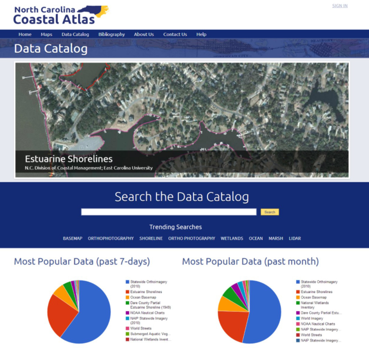
Figure 3: The Data Catalog Search window for the North Carolina Coastal Atlas showing pie diagrams of
the most popular data searched for in the past 7 days and the past month