Red

La membresía de ICAN está abierta a todas las partes interesadas que aceptan la misión y los objetivos de ICAN, incluidos aquellos que tienen un Atlas web costero operativo, así como aquellos que esperan diseñar y construir un Atlas web.

Internacional

ICAN es un proyecto del Programa IODE de la COI de la UNESCO, y los miembros de ICAN buscan desempeñar un papel de liderazgo en la creación de colaboraciones internacionales de valor para las naciones participantes, optimizando así la gobernanza regional en la gestión de zonas costeras y la planificación espacial marina.

Atlas

Los atlas son "...colecciones de mapas digitales y conjuntos de datos con tablas complementarias, ilustraciones e información que ilustran sistemáticamente la costa, a menudo con herramientas cartográficas y de apoyo a la toma de decisiones, todas las cuales son accesibles a través de Internet.."  O'Dea et al., 2007

Costeros

Vivimos en un planeta azul, con océanos y mares que cubren más del 70% de la superficie de la Tierra. Los océanos nos alimentan, regulan nuestro clima y generan la mayor parte del oxígeno que respiramos. Aproximadamente el 37% de la población mundial vive a menos de 100 km de la costa. (UNEP)

¡Únete a nosotros!

Keiran Millard
Esta dirección de correo electrónico está siendo protegida contra los robots de spam. Necesita tener JavaScript habilitado para poder verlo.

HydroView Now is a range of free to use web mapping services developed by SeaZone.  They have been developed for users building  and delivering coastal and marine atlases.  HydroView Now provides all the key base-mapping and reference features generally needed in developing marine and coastal atlases, allowing users to focus on their content and analysis.


Figure 1: A test website showing HydoViewNow:Features, symbolised and displayed alongside
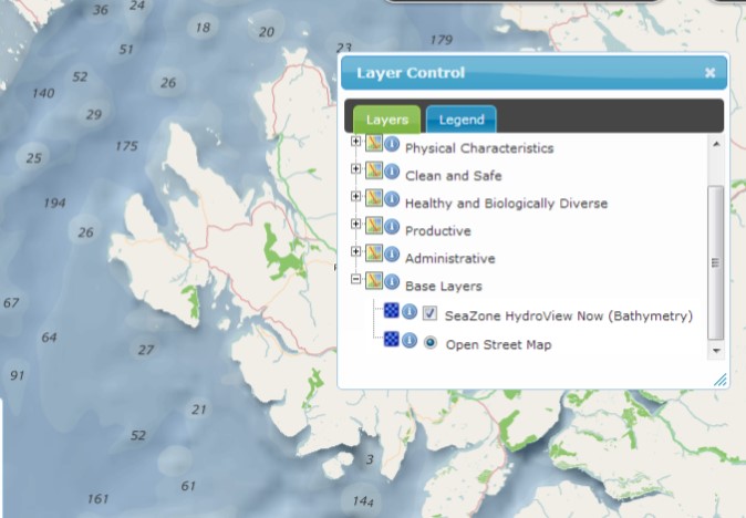
HydroViewNow: Basemap and OpenStreetMap

Fully standards-based, the services work in web mapping applications as well as desktop clients such as ArcGIS and QGIS.  They comprise two services:  HydroView Now: Basemap and HydroView Now: Features.


Figure 2: Seazone Hydroview Now Bathymetry service in use in the MarineScotland interactive marine planning tool
http://www.scotland.gov.uk/Topics/marine/seamanagement/nmpihome/nmpi

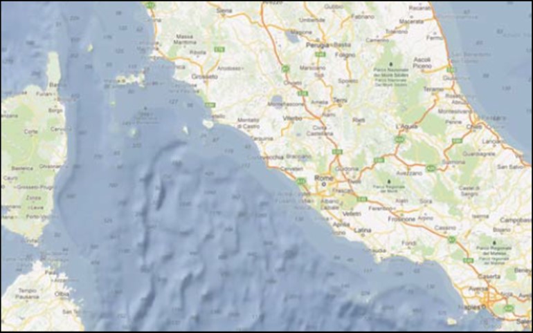
HydroView Now : Basemap

A WMTS for global bathymetry.  This a cartographic product showing hill-shaded bathymetry alongside depth soundings derived from nautical charts.  It contains a transparent land-mask meaning it can be used alongside your choice of land mapping, e.g. OpenStreetMap or BingMaps

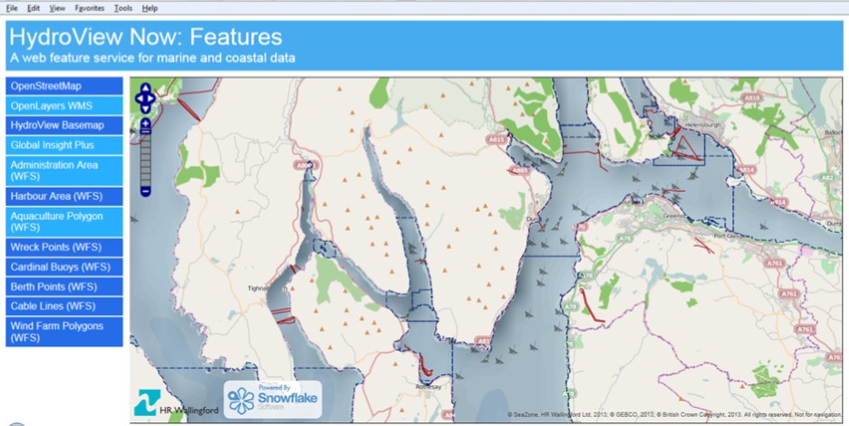
HydroView Now : Features

A WFS for global marine feature types.  This provides a definitive worldwide marine reference feature types derived from national hydrographic and other authoritative sources.  The content is processed to form a continuous vector layer dataset aligned to the draft IHO S-100 GML profile.


Figure 3: HydroView Now BaseMap layered with land mapping for Italy

Both services are delivered through an authenticated web service interface, allowing users to consume the service via an application programming interface.  They are both deployed in the cloud delivering the performance and reliability that users are accustomed to with modern web mapping. 

View HydroViewNow at
http://seazone.viaeuropa.uk.com/viaeuropa/apps/szdemo/


Para nuestras Costas

Vol, 8, Nr 2 - Now Available!

We are now entering our 9th year publishing the ICAN newsletter. Many thanks to our Editor Andy Sherin!

Please consider preparing an article for the next newsletter that will likely be published in the spring of this year.

Happy New Year!

Photos from CoastGIS 2018

Our friends from CoastGIS 2018 have posted a wonderful gallery of photos, including the recent ICAN mini-workshop:

See how many ICAN members you can spot!