
The Wisconsin Coastal Atlas (http://wicoastalatlas.net/) is a web resource that helps people better understand coastal issues, share coastal data, and inform decision-making about sustainable use of the Great Lakes. It is intended for use by coastal resource managers, planners, researchers, educators, tourists, and citizen scientists and builds on many years of collaboration between the University of Wisconsin Sea Grant College Program and the Land Information and Computer Graphics Facility at the University of Wisconsin-Madison to leverage the sizeable investment in local government land information systems and apply geospatial technologies to address Great Lakes issues.
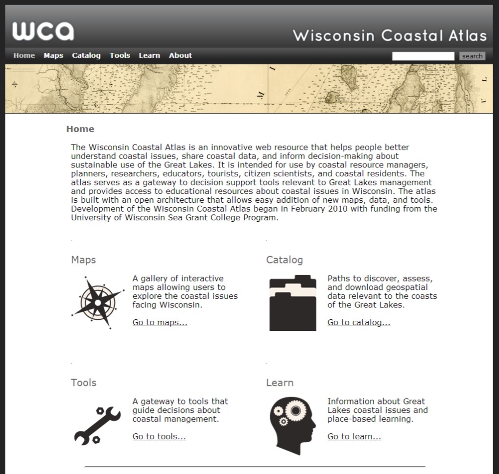
The Wisconsin Coastal Atlas (WCA) is modeled after the Oregon Coastal Atlas (http://coastalatlas.net/) and organized into four sections: maps, catalog, tools, and learn. A gallery of interactive maps provides customized perspectives related to specific coastal issues in Wisconsin. An example is the Fox-Wolf Hydrologic Dashboard, which visualizes the spatial pattern of large precipitation events and the resulting impacts on streamflow. The catalog section of the atlas provides several paths to discover, assess, and download geospatial data for the Great Lakes coasts of Wisconsin. At the center is a simple data download matrix based on the open data catalog at the City of Vancouver, British Columbia. Finally, the atlas serves as a gateway to spatial decision support tools relevant to Great Lakes management and provides access to educational resources about coastal issues in Wisconsin.
The WCA, however, is more than just a web portal that provides access to coastal data and tools – it is also a research project that is helping to build a coastal spatial data infrastructure for Wisconsin. Since February 2010, the project has tackled several research topics, including: 1) structured design and evaluation of web atlases; 2) guidance on making choices among different web mapping technologies; 3) promotion of sound cartographic design principles for web mapping interfaces; 4) development of effective archives for coastal geospatial data; 5) application of ontology tools to promote semantic mediation of local government spatial data sets to conduct spatial analyses of coastal issues at a regional scale; and 6) advancing social science methods to improve the effectiveness of coastal decision support tools. The primary motivation is demonstrating that the atlas can serve as an interoperable resource that both integrates local geospatial data for coastal management in Wisconsin and can serve as a component of a larger networked Great Lakes Coastal Atlas.
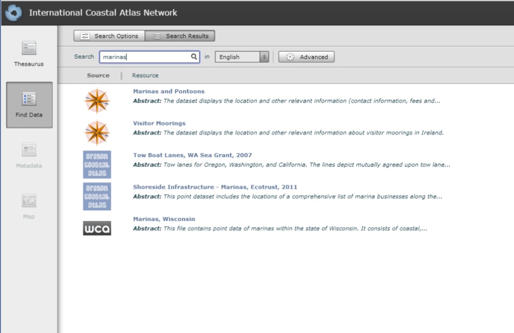
One way to demonstrate the WCA as an interoperable resource is through participation in the ICAN Prototype (http://ican2.ucc.ie/atlas/). A key technologies that supports the WCA is GeoNetwork (http://geonetwork-opensource.org/) - an interoperable geospatial metadata catalog that supports the Catalogue Service for the Web (CSW) standards developed by the Open Geospatial Consortium (OGC). A total of 57 geospatial data sets are documented and accessible through the WCA GeoNetwork. With the assistance of Yassine Lassoued, Roy Lowry and Tanya Haddad, the Wisconsin project team followed the steps in the ICAN semantic interoperability pilot cookbooks developed as part of the NETMAR project (http://netmar.nersc.no/) to connect to the ICAN Prototype. The result is the ability to search for Wisconsin coastal data as part of a global network of coastal atlases.
In an effort to share research findings, papers completed as part of the WCA project are available for download in the “About” section of the atlas. This includes two white papers that may be of interest to the ICAN community:
Bibliography
- Sack, Carl and Tim Wallace. 2012. Tools and Best Practices for Coastal Web Maps
- Sack, Carl. 2013. User-Centered Design for Coastal Web Atlas Maps and Tools: A Process Manual