
The Too Big To Ignore (TBTI) international initiative (http://toobigtoignore.net/) has officially released the first version of their global Information System on Small-scale Fisheries (ISSF), a Web crowdsourcing platform allowing anyone to enter or access information on small-scale around the world. Discover hundreds of individual and organizations studying small-scale fisheries, more than a thousand publications, and soon data on small-scale fisheries from around the world. Contribute your knowledge of small-scale fisheries to the world: http://issf.toobigtoignore.net/
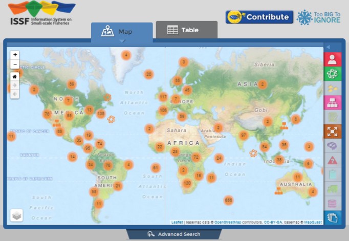
The ISSF is based on a 3-tier architecture composed of a spatial database (PostGIS), a web framework (Django) and a web-mapping client (Leaflet). The database stores relevant SSF information, such as the description and locations of SSF case studies, researchers and organizations. Data were compiled using reviews of the literature and surveys, and will be enriched through a crowdsourcing platform that will allow stakeholders to enter SSF data. The web framework makes the link between the database and the client by translating queries. Data are then presented to the end-user in a web-mapping environment and can be explored using a map or a tabular view. Tools are also provided to help users refine queries, such as filtering selections or performing spatial queries. Users can export in KML or CSV the results of the selection, as well as view and print reports for specific SSF entries. Using ISSF, researchers can conduct a variety of analyses, from simple scenarios handled by ISSF to more complex scenarios analyzed in third party software.
The ISSF is being developed at Memorial University of Newfoundland, St. John’s NL, Canada. Contact: Dr. Rodolphe Devillers (Esta dirección de correo electrónico está siendo protegida contra los robots de spam. Necesita tener JavaScript habilitado para poder verlo.)