A different kind of mapping
- Detalles
- Publicado: 20 Enero 2021 20 Enero 2021
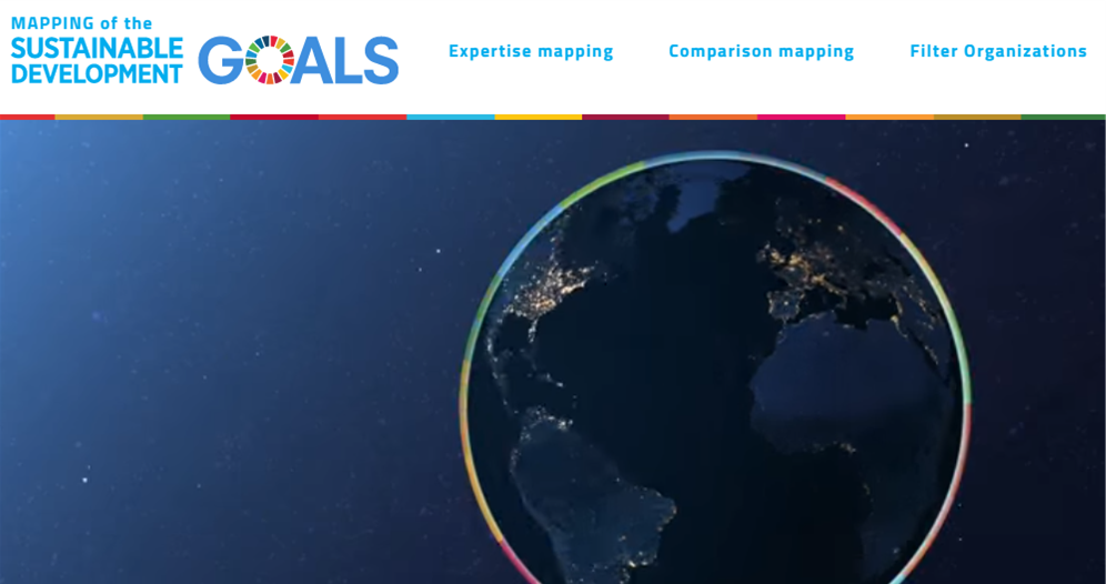
This website (https://www.sdgmapping.ch/) is the second edition of the SDG mapping, which aims to interactively visualize the results of the second SDG survey that documents the expertise of organizations relevant to each SDG. About 100 actors participated in the survey and interactive mapping. They self-assessed their expertise as core, generic or non-applicable in 10 different areas for each SDG. UNESCO, the parent organization for ICAN, has contributed to the survey for SDG 14.
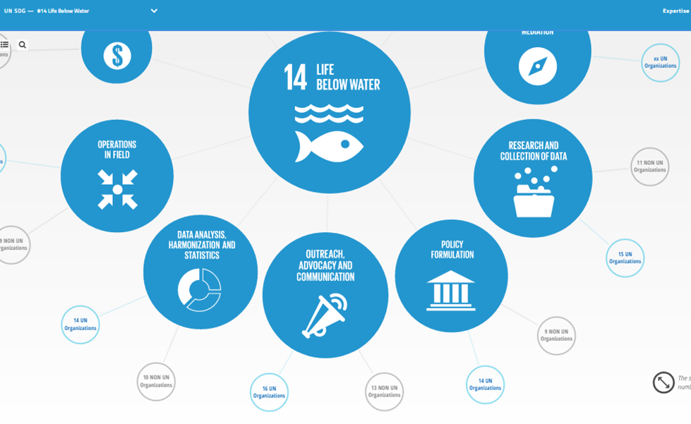
Figure 1: Part of the infographic for SDG 14 Life under water generated interactively from the sdgmapping website.
Data is Power
- Detalles
- Publicado: 01 Enero 2021 01 Enero 2021
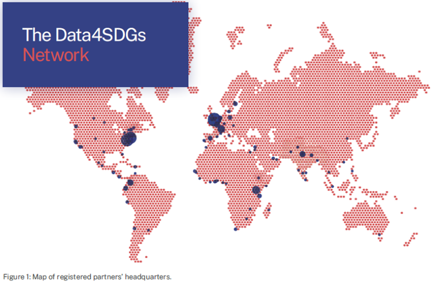
The Five Year (2015-2020) Report of the Global Partnership for Sustainable Development Data (https://www.data4sdgs.org/) has been released. The Global Partnership was created 2015 to put the power of data to change minds, policies and lives at the service of sustainable development.
Since 2015 the Global Partnership has learned:
- Good data takes time: build relationships, change institutions, and learn together.
- Progress depends upon people: understanding and trust are the keys to good partnerships.
- Politics drive technical change; political support is critical to sustainable change at scale.
- Values count: inclusivity and equity must underpin progress on data.
- Systems not silos: interoperability and openness strengthen systems and increase impact.
Some More Atlases for UN Sustainable Development Goals
- Detalles
- Publicado: 01 Julio 2020 01 Julio 2020
Andy Sherin
Esta dirección de correo electrónico está siendo protegida contra los robots de spam. Necesita tener JavaScript habilitado para poder verlo.
Several on-line atlases have been developed that are relevant to the United Nations Sustainable Development Goals. Three are highlighted here. Please send examples of other SDG relevant atlases to Andy at Esta dirección de correo electrónico está siendo protegida contra los robots de spam. Necesita tener JavaScript habilitado para poder verlo. for future articles.
Blue Justice for Small-Scale Fisheries' Commitment
SDG Goal 14b
![]() SDG Goal 14b states “Provide access for small-scale artisanal fishers to marine resources and markets”.
SDG Goal 14b states “Provide access for small-scale artisanal fishers to marine resources and markets”.
Learn more about SDG 14 here
Too Big To Ignore (TBTI) has been promoting the notion of ‘Blue Justice’ through various platforms. One of our most prominent efforts was the registration of Blue Justice for Small-Scale Fisheries as a voluntary commitment to the Ocean Conference to Support the Implementation of Sustainable Development Goal 14 (SDG 14). Our pledge joins more than 1,400 other voluntary commitments to save our oceans, all registered on a UN platform. See TBTI Blue Justice full commitments at https://oceanconference.un.org/commitments/?id=29400
 Figure 1: The Information System for Small Scale Fisheries (ISSF) is a global collaborative online database providing information on small-scale fisheries (SSF) to help enhance knowledge about this sector and their overall contributions. ISSF is available at https://issfcloud.toobigtoignore.net/
The commitment, which is part of our ongoing 'Blue Justice' campaign, calls attention to the current discourse about Blue Growth/Blue Economy, which poses potential risks to the rights of small-scale fisheries to the fishing livelihoods, which include access to fisheries resources, to coastal and ocean space, and to local, national and international markets. The campaign is urging for the social justice of small-scale fisheries be recognized not only as a basic right, but also an important condition for the realization of the UN Sustainable Goals and implementation of the SSF Guidelines.
[Editor’s Note: TBTI last appeared in the ICAN Newsletter in the September 2014 issue.]
Interactive Database of the World’s River Basins
SDG Goal 6
![]() SDG Goal 6: states “Ensure availability and sustainable management of water and sanitation for all.”
SDG Goal 6: states “Ensure availability and sustainable management of water and sanitation for all.”
Learn more about SDG 6 here
The Interactive Database of the World’s River Basins is one of the tools referenced by Inventory of Business Tools https://sdgcompass.org/business-tools/ . This inventory maps existing business tools against the Sustainable Development Goals (SDGs). Interactive Database of the World’s River Basins database provides a compilation of the world’s river basins developed specifically for corporate disclosure. It features a comprehensive list of river basins worldwide, including their names, boundaries, and other helpful information. http://riverbasins.wateractionhub.org/
 Figure 3: Interactive Database of the World’s River Basins
SDG Goal 14
![]() SDG Goal 14: states “Conserve and sustainably use the oceans, seas and marine resources for sustainable development”.
SDG Goal 14: states “Conserve and sustainably use the oceans, seas and marine resources for sustainable development”.
Learn more about SDG 14 here
Many companies provide location-specific information in their water reporting. However, they often don’t have a common reference point for the places they talk about. Because of this, they often refer to the same place by different names, or to different places using the same name. This database solves that problem by allowing you to Find Basins by Latitude / Longitude Points and Find Basins by Country.
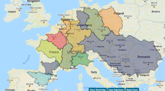 Figure 4: River Basins from Western Europe mapped in the Interactive Database of the World’s River Basins.
Allan Coral Atlas
SDG Goal 14.2
![]() SDG Goal 14.2 states: “By 2020, sustainably manage and protect marine and coastal ecosystems to avoid significant adverse impacts, including by strengthening their resilience, and take action for their restoration in order to achieve healthy and productive oceans.”
SDG Goal 14.2 states: “By 2020, sustainably manage and protect marine and coastal ecosystems to avoid significant adverse impacts, including by strengthening their resilience, and take action for their restoration in order to achieve healthy and productive oceans.”
Learn more about SDG 14 here
Arizona State University’s Center for Global Discovery and Conservation Science, the National Geographic Society, Planet, the University of Queensland, and Vulcan Inc. are working to expand the Allen Coral Atlas. With the Atlas, coral conservationists, reef managers and scientists have access to high quality information that has never before been available at this global scale.
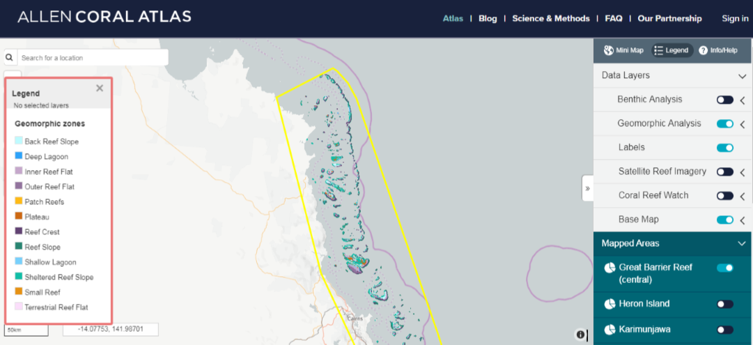
The Allen Coral Atlas is built by a dedicated team of scientists, technologists, and conservationists, using one-of-a-kind methodologies, led and funded by Vulcan Inc.
It all starts with 3.7m satellite imagery. With this data in hand, distorting “noise” in the imagery is taken out. Algorithms then correct for the effects of the atmosphere and sun glint on the surface of the water, and then depth is calculated. Next, field data is used to calibrate rule sets before generating a habitat map with machine learning. The resulting map is then displayed on the Allen Coral Atlas website, and the Atlas Engagement team works with scientists, academics, policymakers, and protected area managers to facilitate use.
Fair winds, Roger!
- Detalles
- Publicado: 30 Diciembre 2020 30 Diciembre 2020
As of the end of 2020, Roger Longhorn has retired from the ICAN Steering Group, the IHO Marine SDI WG, and the OGC Marine Domain WG. He is now looking forward to spending more time on his boat than on the computer :)
All the best to Roger on his new adventures!
The Ocean InfoHub Project
- Detalles
- Publicado: 01 Julio 2020 01 Julio 2020
By Lucy Scott
The Intergovernmental Oceanographic Commission (IOC) Ocean InfoHub Project (OIH) is a new initiative to streamline access to ocean science data and information for management and sustainable development.
The OIH will establish and anchor a network of regional and thematic nodes that will improve online access to and synthesis of existing global, regional and national data, information and knowledge resources. The project will center on an openly accessible web platform designed to support interlinkages and interoperability between distributed resources including existing clearinghouse mechanisms. The OIH will first consolidate IOC-associated online resources - including OceanExpert, OceanDocs, the Ocean Best Practices System, the Ocean Biodiversity Information System (OBIS), the World Ocean Database (WOD) and Ocean Data Portal (ODP) – extended by partnerships with EurOcean, Marinetraining.eu, EMODNET, and other sources in the IOC ODIS Catalogue of Sources (ODIScat). The initial focus of OIH will thus be on (i) experts, (ii) institutions/organizations, (iii) research data and information infrastructures and their capabilities and services offered, (iv) projects, (v) research vessels, (vi) education and training opportunities, (vii) funding programs and other opportunities, (viii) documents and publications, (ix) manuals, guidelines, standards and best practices, (xi) metadata catalogue for specific variables and (xii) access to data sets and/or data products relevant to particular program priorities, including spatial data and maps (e.g. the SDGs and Essential Ocean Variables).
ICAN member atlases are invited to make contact with the OIH team, in the hope that one or more atlas projects could participate in a pilot interoperability test with the global OIH, and thus become part of a demonstration exchange of spatial data.
The project will benefit marine and coastal stakeholders across the globe, but its initial focus will be on responding to requests for data products and services from three regions: IOCAFRICA, LAC and the Pacific SIDS to meet their unique user community (thematic and language) requirements. The initial priorities for the Project will be to develop communities of practice for the three pilot regions, as well as to formalize partnerships with other UN agencies and key international partners. A global ODIS (Ocean Data and Information System) architecture will be developed to enable scalable development and interoperability with local, regional and thematic infrastructures. Through these actions, the OIH will enable a digital ecosystem where users, from any entry point, can discover content and services that they require, while also having opportunities to become content creators themselves.
Matchmaking services would be an additional function of the OIH, particularly in support of the IOC Capacity Development strategy. Services would allow study and training or vessel survey opportunities to be identified, a peer-to-peer service would support scientific collaboration, and an automated/self-serve service would allow the search for specific human or institutional expertise. The project will also focus on the transfer of local knowledge, on supporting early career scientists, and on remedying gender disparity by increasing access to information, technologies and opportunities, in line with the IOC’s Capacity Development strategy.
Ultimately, the OIH intends to meet the knowledge needs of national and regional requirements for sourcing marine data and information, as well as to assist countries in their reporting requirements for the Sustainable Development Goals (particularly goals 4,9, 14 and 17), contribute to key aims of the UN Decade of Ocean Science for Sustainable Development, the Paris Agreement, the Sendai Framework for disaster Risk Reduction and Marine Biological Diversity of Areas Beyond National Jurisdiction. The OIH will also assist IOC member states to report on ocean science capacities through the Global Ocean Science Report (GOSR).
Funded by the Government of Flanders (Kingdom of Belgium), the project started in April 2020 and will run for three years. The OIH is coordinated by the IOC Project Office for IODE (Oostende, Belgium), building on its 59-year history of supporting member states in the exchange and management of marine data and information.
For more information:
- Ocean InfoHub Project: https://www.iode.org/oih
- ODIScat: https://catalogue.odis.org/
Email Lucy Scott, UNESCO/IOC Project Office for IODE, Esta dirección de correo electrónico está siendo protegida contra los robots de spam. Necesita tener JavaScript habilitado para poder verlo.
