The United Nations forms a Working Group on Marine Geospatial Information
- Detalles
- Publicado: 05 Enero 2018 05 Enero 2018
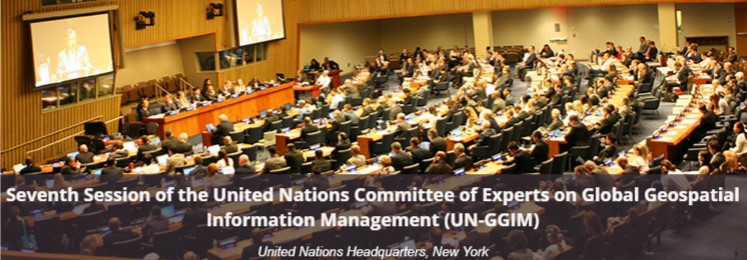
The United Nations Committee of Experts on Global Geospatial Information Management (UN-GGIM) have formed a new Working Group on Marine Geospatial Information at its 7th Session held in New York 31 July to 4 August 2017.
The formation of the Working Group follows on submission of a report to the UN-GGIM from the International Hydrographic Organization (IHO) that concluded “the establishment of a specific body that will enable the high level of global guidance and coordination that the GGIM currently provides in the land geospatial information domain to be extended and harmonized with the maritime and water domain is a logical development.”

The report on this topic from the UN-GGIM sessions states “The availability and accessibility of high-quality, timely and reliable geospatial information is vital in order to make informed decisions and to ensure accountability for the implementation of the 2030 Agenda for Sustainable Development. Follow-up and review of progress on the Sustainable Development Goals (SDGs) requires the collection, analysis and dissemination of an unprecedented amount of data and statistics including that for inland water bodies and waterways and coastal zones, seas and oceans. The availability of marine geospatial data, particularly bathymetry, of our seas and oceans is currently less than optimal.”
The Working Group on Marine Geospatial Information aims to provide a forum for dialogue and coordination between Member States, the United Nations system, the International Hydrographic Organization, and other international organisations and experts with a view to encourage enhanced global cooperation to substantively address issues related to the availability and application of marine geospatial information. Its objectives include:
- Raising political awareness and highlighting the importance of marine geospatial information to support the administration, management and governance of the marine environment;
- Encouraging the use of internationally agreed-upon geospatial information frameworks, schemas, systems and established standards; and
- Supporting UN-GGIM in the development of norms, principles, guides and standards to increase significantly the availability of high-quality, timely and reliable geospatial information including any regional capacity development initiatives.
Full reports on the 7th Session of the UN-GGIM are available at:
http://ggim.un.org/meetings/GGIM-committee/7th-Session/documents/
