
OceanWise offers WMS of IMO Adopted Areas
- Detalles
- Publicado: 15 Septiembre 2014 15 Septiembre 2014
OceanWise, the independent marine data management and publishing specialist, has recently included Traffic Separation Schemes (TSS), Particularly Sensitive Sea Areas (PSSA) and other International Maritime Organisation (IMO) adopted areas in its marine mapping dataset, Marine Themes. The areas are available in GIS compatible file formats and as an OceanWise hosted OGC compliant web service making the data ideally suited for inclusion in web based coastal and marine atlases and similar systems.
The IMO adopted area datasets are captured from approved IMO documentation and converted into GIS compatible formats under license. The dataset is normally updated within 5 working days of proposed new or amended areas being published and are therefore available to value added publishers and end users as soon as they are adopted.
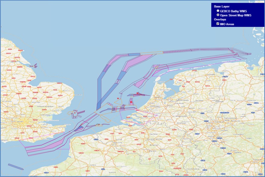
In addition to incorporating the IMO adopted areas into Marine Themes, OceanWise has launched an OGC compliant Web Map Service (WMS) for the data. The IMO Areas WMS contains worldwide data and can be read directly into most desktop and web based Geographic Information Systems (GIS). It is ideal for organizations, including progressive Hydrographic Offices, wishing to access definitive source data rather than legacy datasets that have been captured from paper charts. The image shows OceanWise’s IMO Areas WMS in conjunction with OpenStreeMap, although other base maps, such as the GEBCO worldwide bathymetric dataset, OceanWise’s ENC WMS and of course Marine Themes itself are also available.
For more information contact Esta dirección de correo electrónico está siendo protegida contra los robots de spam. Necesita tener JavaScript habilitado para poder verlo.
Scotland’s National Marine Plan interactive continues to grow
- Detalles
- Publicado: 12 Septiembre 2014 12 Septiembre 2014
National Marine Plan interactive is about to reach 400 layers. This represents a huge data resource for marine planning stakeholders, available on their own PC. We have come a long way in the last few years in making data available on-line.
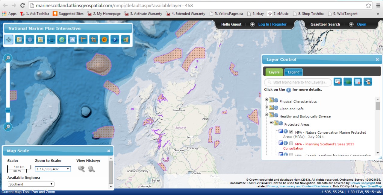
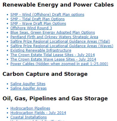 New data layers continue to be added and amongst recent layers are the ‘Marine Protected Areas’ designation and ‘Draft Special Protection Areas’ made in July 2014. Also, all the draft National Marine Plan maps, on which Marine Scotland consulted last year, can now be found in a new section called ‘Draft National Marine Plan – 2013’ as an archive of the spatial data in the draft plan. Updated data sets for these maps will be added to NMPi.
If you would like a url to a specific data layer to use in documents (which will open NMPi with that data layer turned on), you can obtain these from a new feature - List of available layers (copy the short cut under the hyperlink).
Marine Scotland continues to work with its partners Scottish Environmental Protection Agency (SEPA), Scottish Natural Heritage (SNH), Joint Nature Conservation Committee (JNCC), the Marine Alliance for Science and Technology Scotland (MASTS) and the emerging regional marine planning partnerships, to develop layers that will be relevant and valuable for both national and regional marine planning.
Feedback on NMPi is always welcome and can be e-mailed to Esta dirección de correo electrónico está siendo protegida contra los robots de spam. Necesita tener JavaScript habilitado para poder verlo.