
ICAN 6: Report now available
- Detalles
- Publicado: 18 Marzo 2014 18 Marzo 2014
Ned Dwyer,
Kathrin Kopke
The full report on the ICAN 6 workshop held in June 2013 is now available on the ICAN website at: http://www.oceandocs.org/handle/1834/6612. Here is a sneak preview of the Executive Summary.
From June 16th to 17th, 2013, the International Coastal Atlas Network (ICAN) held a workshop on “Expanding Participation in Coastal Web Atlas Development and Use”, at the University of Victoria, British Columbia, Canada. The workshop (aka “ICAN 6”) engaged 29 participants from 9 countries, representing 22 organizations and multiple areas of scientific and technical expertise. This meeting was a follow-up to the successful 2011 workshop on “Coastal Atlases as Engines for Coastal & Marine Spatial Planning” (aka “ICAN 5”) held in Oostende, Belgium, as well as workshops in 2009, 2008, 2007 and 2006.
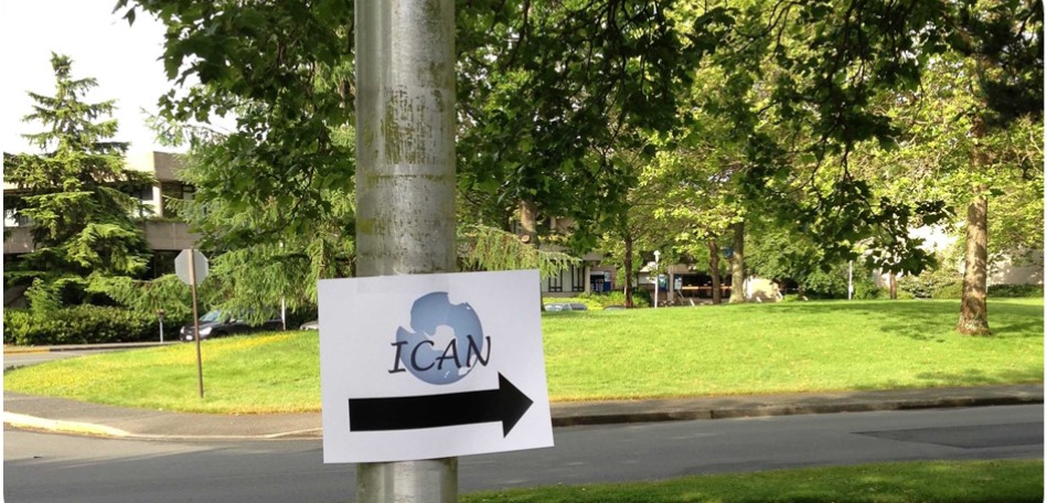
Follow the sign to find out more about ICAN 6
ICAN 6 provided an opportunity to discuss how the ICAN community could take advantage of now being an IODE project to share its knowledge and aid capacity building among IOC member states in relation to coastal and marine data management. Moreover, ICAN has seen its membership grow in the last two years and given its extensive membership along the North and South American Pacific coasts it was a great opportunity to hear about atlas developments in those regions.
Key activities at the workshop included:
- exploring the opportunities for ICAN in an IODE context and how to build synergies with other IOC projects; the activities of the Ocean Biogeographic Information System (OBIS) project of the IOC were presented as well as IOC’s ICAM programme which highlighted how data management tools developed within ICAN can contribute to the goals of ICAM. Beyond the IOC, activities within the Group on Earth Observations’ (GEO) Coastal Zone Community of Practise (CZCP) are very relevant to ICAN, in particular the objective to develop a global coastal zone information system (CZIS). ICAN can help inform the development of such a CZIS
- discussion of coastal atlas training needs and how ICAN members can contribute; in particular the training requirements of the African Coastal and Marine Atlas, and the Caribbean Marine Atlas were discussed. An overview of IODE training activities was presented and linkages on training between ICAN and ICAM related projects (e.g. SPINCAM II) were discussed. ICAN should also take advantage of the OceanTeacher platform developed by IODE
- Atlas Stories – presentations from Atlas developers and users from North and South American Pacific coasts and beyond; the ICAN 6 Atlas Stories focused on CWA development around the Western Pacific Rim presenting new activities as well as updating the network on recent upgrades to previously discussed CWAs. The session started with the South American SPINCAM project which is developing atlases across five countries, followed by updates on the Oregon Coastal Atlas and the Washington State Coastal Atlas. Workshop participants also learned about Canada’s CanCoast and ShoreZone and the session concluded with the introduction to SmartAtlas through the African Coastal & Marine Atlas Experience
- a small “workshop within a workshop” for atlas technical developers on how to become a new node in the ICAN interoperability portal, version 3; The latest version has multilingual search capability, semantic search and the ability to connect directly to map services and display the results in a map. It was agreed that the current interface will be upgraded to HTML5 in the coming period
- a small “workshop within a workshop” focussing on Volunteered Geographical Information (VGI) and its implications for coastal atlases; within the EEA, systems have been developed using both crowdsourcing and citizen science approaches. SeaSketch is a software platform intended as an end-to-end mapping solution for marine spatial planning, which allows anyone, regardless of their technical abilities, to sketch prospective management plans and receive analytical feedback on the consequences of their designs. The Marine Regions project aims to develop a standard for georeferenced marine names and there is potential to link it to the ICAN portal. Esri is introducing the concept of a “living Atlas” which is delivered via ArcGIS Online (AGOL). ICAN members can take advantage of this concept by using it to leverage their existing Atlas holdings or by using the platform to build a new Atlas quickly
- development of an ICAN work plan for the period 2013-2015; this included plans for developing a communications strategy, a handbook on how atlas developers and users can interact and building synergies with other IOC and non-IOC projects. It also looked at developing a coastal atlas training plan. At its core ICAN supports atlas development and interoperability approaches, therefore the Technical Committee presented its plans for developments in the next two years.
The workshop concluded with the first face-to-face meeting of the new Steering Group, which was put in place after ICAN became an IODE project. This meeting saw two new members join the SG and appointed leads to the various work plan elements.
Since ICAN 6 there have been developments in relation to the work plan. A revised plan and associated budget request was submitted to the IODE Officers meeting held in March 2014. As IODE has a limited budget and a number of projects to support, not all work plan items will receive funding, however the funding allocated will be of significant assistance to maintain ICAN and help progress its work. ICAN is now on a sound footing as part of the IODE family of projects, although members should continue to seek funding from other sources to advance the key technical activities. This ambitious work plan will require the commitment of all members to ensure that it can be implemented. A priority for 2014 is the redevelopment of the web site in order to make it easier to navigate and more responsive to user needs. Interoperability remains a core activity of ICAN and the technical committee has proposed a number of activities to progress further the developments in this area. A key technical concept which emerged at ICAN 6 was that of an “atlas-in-a-box”. The idea is that a new atlas developer can get started quickly on implementing and publishing a CWA with a minimal amount of technical/programming knowledge. The committee intends to scope the feasibility of such a development based on potential solutions such as SmartAtlas and ArcGIS Online.
We would like to thank Rosaline Canessa and her team at the University of Victoria for their warm welcome and excellent hosting of ICAN-6 and we look forward to seeing you at the 7th International workshop (aka “ICAN 7”) which will be hosted in South Africa from 20-21 April 2015 just before CoastGIS 2015.
The Wisconsin Coastal Atlas: Helping Build a Coastal Spatial Data Infrastructure
- Detalles
- Publicado: 14 Marzo 2014 14 Marzo 2014
The Wisconsin Coastal Atlas (http://wicoastalatlas.net/) is a web resource that helps people better understand coastal issues, share coastal data, and inform decision-making about sustainable use of the Great Lakes. It is intended for use by coastal resource managers, planners, researchers, educators, tourists, and citizen scientists and builds on many years of collaboration between the University of Wisconsin Sea Grant College Program and the Land Information and Computer Graphics Facility at the University of Wisconsin-Madison to leverage the sizeable investment in local government land information systems and apply geospatial technologies to address Great Lakes issues.
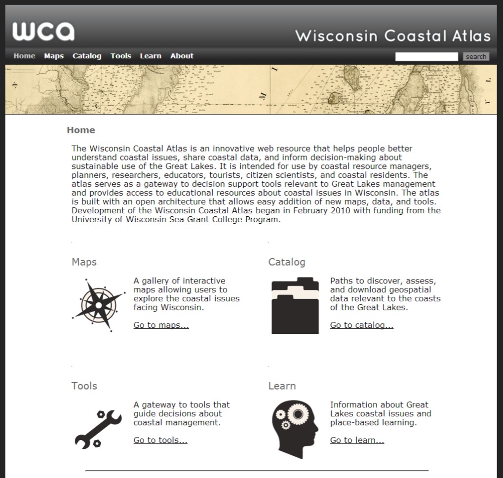
The Wisconsin Coastal Atlas (WCA) is modeled after the Oregon Coastal Atlas (http://coastalatlas.net/) and organized into four sections: maps, catalog, tools, and learn. A gallery of interactive maps provides customized perspectives related to specific coastal issues in Wisconsin. An example is the Fox-Wolf Hydrologic Dashboard, which visualizes the spatial pattern of large precipitation events and the resulting impacts on streamflow. The catalog section of the atlas provides several paths to discover, assess, and download geospatial data for the Great Lakes coasts of Wisconsin. At the center is a simple data download matrix based on the open data catalog at the City of Vancouver, British Columbia. Finally, the atlas serves as a gateway to spatial decision support tools relevant to Great Lakes management and provides access to educational resources about coastal issues in Wisconsin.
The WCA, however, is more than just a web portal that provides access to coastal data and tools – it is also a research project that is helping to build a coastal spatial data infrastructure for Wisconsin. Since February 2010, the project has tackled several research topics, including: 1) structured design and evaluation of web atlases; 2) guidance on making choices among different web mapping technologies; 3) promotion of sound cartographic design principles for web mapping interfaces; 4) development of effective archives for coastal geospatial data; 5) application of ontology tools to promote semantic mediation of local government spatial data sets to conduct spatial analyses of coastal issues at a regional scale; and 6) advancing social science methods to improve the effectiveness of coastal decision support tools. The primary motivation is demonstrating that the atlas can serve as an interoperable resource that both integrates local geospatial data for coastal management in Wisconsin and can serve as a component of a larger networked Great Lakes Coastal Atlas.
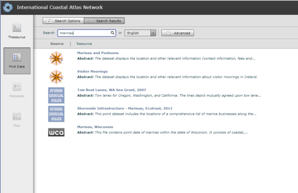
One way to demonstrate the WCA as an interoperable resource is through participation in the ICAN Prototype (http://ican2.ucc.ie/atlas/). A key technologies that supports the WCA is GeoNetwork (http://geonetwork-opensource.org/) - an interoperable geospatial metadata catalog that supports the Catalogue Service for the Web (CSW) standards developed by the Open Geospatial Consortium (OGC). A total of 57 geospatial data sets are documented and accessible through the WCA GeoNetwork. With the assistance of Yassine Lassoued, Roy Lowry and Tanya Haddad, the Wisconsin project team followed the steps in the ICAN semantic interoperability pilot cookbooks developed as part of the NETMAR project (http://netmar.nersc.no/) to connect to the ICAN Prototype. The result is the ability to search for Wisconsin coastal data as part of a global network of coastal atlases.
In an effort to share research findings, papers completed as part of the WCA project are available for download in the “About” section of the atlas. This includes two white papers that may be of interest to the ICAN community:
Bibliography
- Sack, Carl and Tim Wallace. 2012. Tools and Best Practices for Coastal Web Maps
- Sack, Carl. 2013. User-Centered Design for Coastal Web Atlas Maps and Tools: A Process Manual