
News
ICAN contributes to planning for UN Decade of Ocean Science
- Detalles
- Categoría: News News
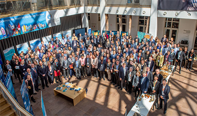
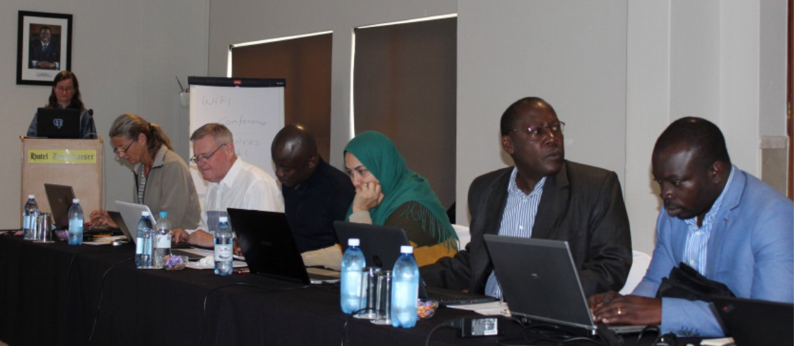
ICAN was represented by Steering Group Member Ned Dwyer at the recent 1st Global Planning Meeting for the UN Decade of Ocean Science for Sustainable Development, held in Copenhagen, Denmark from 13-15 May 2019.
As was mentioned more than once during the meeting the UN Decade offers the ocean community a once-in-a-life-time opportunity to join efforts, mobilise resources, create partnerships and engage governments and other stakeholders in moving towards “the Ocean We Need for the Future We Want”.
Leer más: ICAN contributes to planning for UN Decade of Ocean Science
HELCOM map and data service updated – enhanced system for making available assessment data products and underlying data
- Detalles
- Categoría: News News
Joni Kaitaranta and Andžej Miloš, HELCOM Secretariat
Introduction
HELCOM (Baltic Marine Environment Protection Commission - Helsinki Commission) is the governing body of the Convention on the Protection of the Marine Environment of the Baltic Sea Area, known as the Helsinki Convention. The Contracting Parties are Denmark, Estonia, the European Union, Finland, Germany, Latvia, Lithuania, Poland, Russia and Sweden. HELCOM works to protect the Baltic Sea from all sources of pollutions through intergovernmental cooperation. HELCOM is a regional sea convention (RSC) for the Baltic Sea and policy maker for the Baltic Sea area by developing common environmental objectives and actions. One of HELCOM’s task is to act as an environmental focal point providing information which requires GIS web mapping tool for providing information and data used in assessment carried out by HELCOM.
HELCOM Map and Data service (HELCOM MADS) was designed to fulfill that requirement and first version was developed in 2010. During 2016 a project was launched where resources were made available to completely renew and update the tool that was reaching the end of its life-span.
Requirements and use cases
Fundamental requirement for tools used in making available data stems from HELCOM Monitoring and Assessment Strategy, which contains attachment of Data and Information Strategy. The strategy sets out following guiding principle: The HELCOM data and information activities should facilitate access of the general public to environmental information. This includes requirements for various thematic datasets ranging from in-situ monitoring of eutrophication, biodiversity and hazardous substances related data to more aggregated data products on status of marine environment, nutrient loading and trends and overview of maritime traffic related activities.
HELCOM Contracting Parties that are also EU Member State have obligation stemming from Marine Strategy Frame Work Directive (MSFD). The Directive requires coherence and coordination within regions and makes possible reference to assessments/data that is done by Regional Sea Conventions. This sets requirements in relation to data products being made available on regional level and according to INSPIRE Directive.
Maritime Spatial Planning (MSP) requires also regional coordination and coherence of plans across the region and between neighboring countries. According to the MSP Directive, plans should be harmonized across the region and this requires regional level work and agreement on data harmonization. Spatial data should be also spatially very accurate and up-to-date to be useful in the planning process.
According to HELCOM data and information strategy, the target group for information and data products should be also general public / decision makers. This sets a requirement on complexity of information and terms used for displaying results. This purpose sets a requirement to be able to pinpoint to a specific aggregated and simplified map product in the service.
Technical solutions
HELCOM MADS is based on two user interfaces, which are seamlessly interlinked:
- Map and Data service map viewer part (ESRI ArcGIS Server and ArcGIS API for Javascript) http://maps.helcom.fi/website/mapservice/index.html
- Viewing a dataset and feaure attributes on map viewer;
- Searching dataset in table of contents;
- Viewing external datasets (WMS);
- Data service addresses (ArcGIS Rest / OGC WMS);
- Accessing datasets and features by URL parameters
- Metadata catalogue part (Geonetwork) http://metadata.helcom.fi/geonetwork/srv/eng/catalog.search#/home
- Viewing, downloading and searching metadata records (INSPIRE compliant).
Each dataset has a unique ID, which is used to link a record in the metadata catalogue with a dataset in the map viewer. Linkage is done by including ID in the map viewer and metadata catalogue URL. At anytime user can switch between two systems: to view dataset in the map viewer or read metadata and download dataset in the metadata catalogue (Fig. 1).
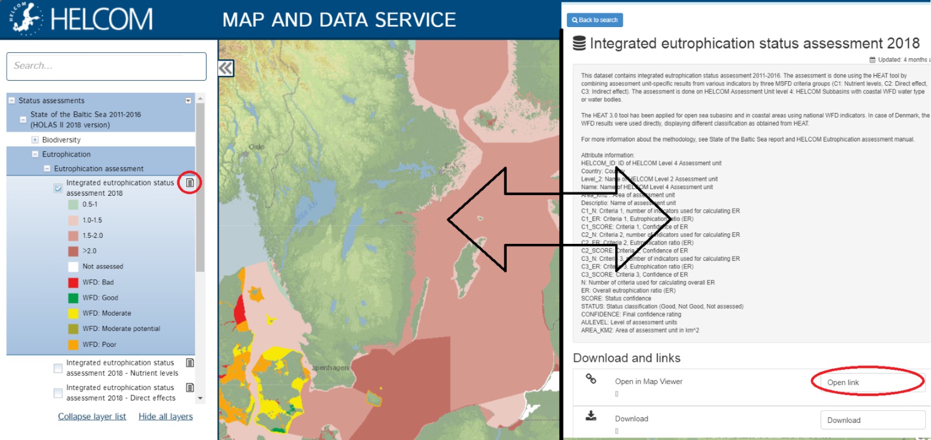
Figure 1. Visualization of a dataset in the map viewer (left hand side) and metadata record in metadata catalogue (right)
Map and Data service viewer is based on datasets stored in file Geodatabases and published in ArcGIS Server (10.6.1). The Map viewer user interface is developed by HELCOM Secretariat using ArcGIS API for Javascript. The source code for the map viewer part can be found at GitHub under GNU General Public License v3.0: https://github.com/helcomsecretariat/MADS.
The main features of map viewer (Figure 2) are:
- Searchable table of contents
- Linkage between to metadata catalogue, accessing datasets and features via URL
- feature identification
- Attribute table widget
- Widget to add WMS services (from predefined list and custom)
- Ability to query features with URL parameters
HELCOM Metadata catalogue is an application of Geonetwork and utilizing INSPIRE compatible metadata template with GEMET thesauri. The metadata catalogue contains following features:
- Search feature for metadata records titles and content
- Downloadable content of each metadata record
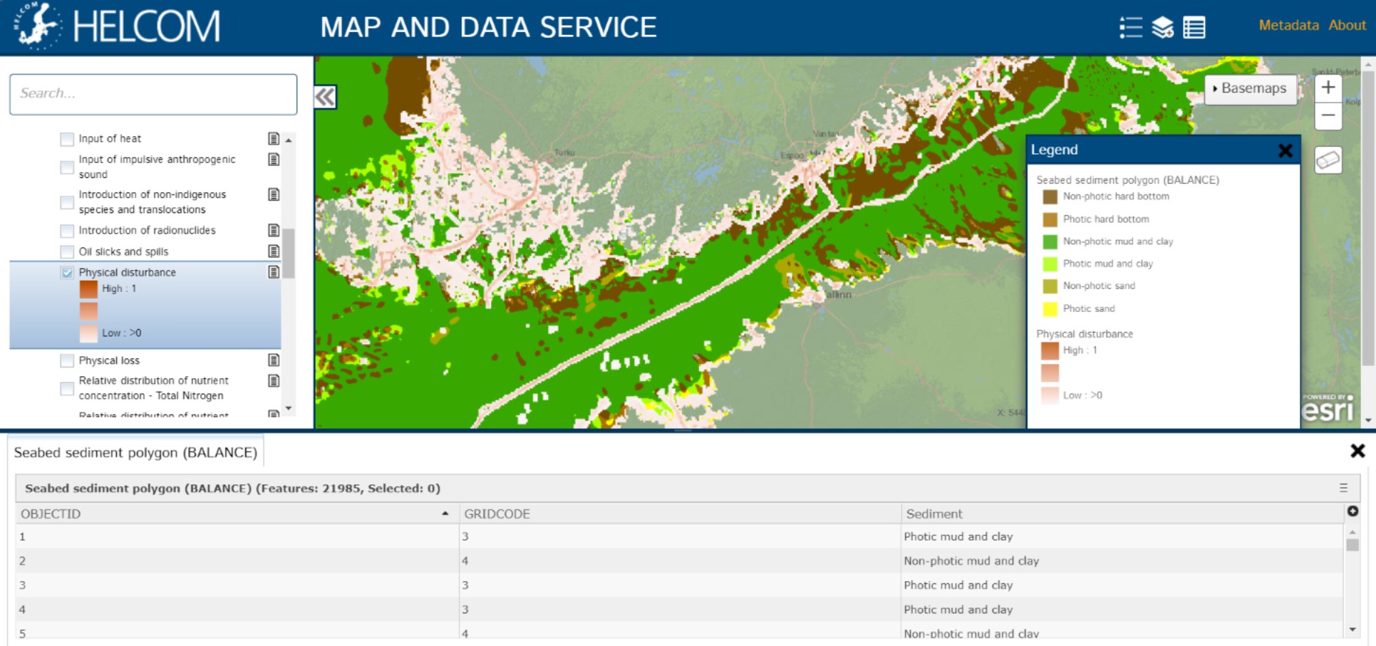
Figure 2. Screenshot of HELCOM Map and Data service map viewer. On the left hand side searchable table of contents, at the bottom extendable attribute table widget and right hand side legend widget
ICAN supports ACMA migration to GeoNode
- Detalles
- Categoría: News News
 The African Coastal and Marine Atlas (ACMA) editorial team supported by Greg Reed from IODE, Tanya Haddad, ICAN Technical team, and Carlos Oliveros from the Caribbean Marine Atlas, held a meeting in November 2017 to discuss the migration of ACMA to a new content management system using the open source software GeoNode. As this new system would be more functional and sustainable for marine spatial planning than the existing ACMA, the Marine Spatial Management and Governance Project (MARISMA) supported the development of GeoNode for the Benguela Current Convention and its member states (Angola, Namibia and South Africa), using the data layers from ACMA as baseline and additional relevant national/regional spatial data.
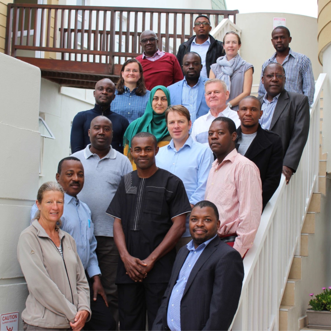
From 12 to 16 March 2018 MARISMA together with IOC/Africa hosted a GeoNode workshop in Swakopmund, Namibia. The objective of the workshop was to start with the migration of the African Coastal and Marine Atlas to the new GeoNode platform. Greg Reed and Tanya Haddad joined participants from Angola, Côte d’Ivoire, Kenya, Madagascar, Namibia, Nigeria and Tunisia to provide training and advice. After installing GeoNode on all laptops, the first two days were spent on training and customizing the look and feel of GeoNode. During the remaining three days participants uploaded and standardized their country and region layers.
The Ecosystem Advisory Committee of the Benguela Current Convention (BCC) has approved the request to host GeoNode by the BCC Secretariat for the member states. In 2019 the data and information of the Current Status Report, compiled by the Namibian MSP National Working Group and MARISMA as well as relevant data and information compiled by the Angolan MSP Working Group will be uploaded and made available online.
United Nations Decade of Ocean Science for Sustainable Development
- Detalles
- Categoría: News News
 What is the UN Decade of Ocean Science?
The United Nations Decade of Ocean Science for Sustainable Development (2021-2030) is an initiative launched by the UN in December 2017. It seeks to drawn attention to the importance of ocean science data and information in the management decisions that will help the world make progress to the 2030 Sustainable Development Goals (SDGs), particularly Goal 14 – the ocean sustainability goal. The Decade will start in 2021, and planning for the decade will occur in the 2018-2020 time period. The IOC has been tasked by the UN General Assembly to work with all interested stakeholders to design a “Decade of Ocean Science” that will help us to deliver the ocean we need for the future we want.
What is the aim of the Decade of Ocean Science?
The objective of the Decade is to strengthen the international cooperation needed to develop the scientific research and innovative technologies that can connect ocean science with the needs of society, and to support countries in achieving the 2030 Agenda for Sustainable Development. The Decade will require the engagement of many different stakeholders to create new ideas, solutions, partnerships and applications, these include: scientists, governments, academics, policy makers, business, industry and civil society.
What will the Ocean Decade focus on as Research & Development Priority Areas?
The Decade will provide a framework for achieving a number of high level outcomes, clustered around:
- a comprehensive digital atlas of the world
- a comprehensive ocean observing system for all major basins
- a quantitative understanding of ocean ecosystems and their functioning as the basis for their management and adaptation
- a data and information portal supporting the decade outcomes
- an integrated multi-hazard warning system
- an ocean in earth-system observation, research and prediction, supported by social and human sciences and economic valuation
- capacity building and accelerated technology transfer, training and education, and ocean literacy
How will the Decade of Ocean Science achieve its goals?
The Decade is embracing a participative process so that scientists, policy makers, managers, and service users can work together to ensure that ocean science delivers greater benefits for both the ocean ecosystem and for society. A two way process is envisioned (top down and bottom-up): the objectives and outcomes will be agreed globally and every group and region of the world will support them. The bottom-up process will be established so as to allow for the regional or even local definition of these outcomes and objectives, with the formulation of scientific products, activities and partnerships that could be proposed in the context of the Decade.
Overall the Decade will mobilize resources towards:
- TRANSFORMING - knowledge systems to support sustainable development
- BOLSTERING - ocean observing and data systems
- MEASURING - cumulative impacts for effective solutions
- DELIVERING - best available knowledge to decision-makers
- REDUCING - vulnerability to ocean and coastal hazards
- ACCELERATING - transfer of marine technology, training and education
What Does the Ocean Decade Mean For You?
The success of the Decade will rely on the contributions of many different stakeholders including scientists, policy-makers, civil society, funders and the private sector. It will support a new cooperative framework to ensure that global ocean science provides greater benefits for ocean ecosystems and wider society. One hoped for outcome will be improvements in alignment between investments and high impact ocean science connections to management. Another is that the Decade will open up access to tools, information and investment needed to create solutions for ocean sustainability.
How can you help?
During the planning phase (right now!) of the Decade a call for inputs and contributions towards the planning phase of the Decade will be launched including opportunities to:
- Contribute to the Planning Process by submitting ideas or participate in Decade dedicated workshops and / or host and organize events.
- Consult stakeholders, communicate about the Decade and identify opportunities for investment and resource mobilization.
- Provide staff and/or financial support.
- Help the IOC and its preparatory activities.
- Communicate about the Decade by sharing the purpose and expected results of the Decade, its planning phase and preparatory activities.
Progress of Sustainable Development Goal 14 in 2018
- Detalles
- Categoría: News News
Advancing the sustainable use and conservation of the oceans continues to require effective strategies and management to combat the adverse effects of overfishing, growing ocean acidification and worsening coastal eutrophication. The expansion of protected areas for marine biodiversity, intensification of research capacity and increases in ocean science funding remain critically important to preserve marine resources.
The global share of marine fish stocks that are within biologically sustainable levels declined from 90 per cent in 1974 to 69 per cent in 2013.
Studies at open ocean and coastal sites around the world show that current levels of marine acidity have increased by about 26 per cent on average since the start of the Industrial Revolution. Moreover, marine life is being exposed to conditions outside previously experienced natural variability.
Global trends point to continued deterioration of coastal waters due to pollution and eutrophication. Without concerted efforts, coastal eutrophication is expected to increase in 20 per cent of large marine ecosystems by 2050.
As of January 2018, 16 per cent (or over 22 million square kilometres) of marine waters under national jurisdiction—that is, 0 to 200 nautical miles from shore—were covered by protected areas. This is more than double the 2010 coverage level. The mean coverage of marine key biodiversity areas (KBAs) that are protected has also increased—from 30 per cent in 2000 to 44 per cent in 2018.
Sustainable Development Goal 14: Life Under Water
Targets |
Indicators |
||
14.1 |
By 2025, prevent and significantly reduce marine pollution of all kinds, in particular from land-based activities, including marine debris and nutrient pollution |
14.1.1 |
Index of coastal eutrophication and floating plastic debris density |
14.2 |
By 2020, sustainably manage and protect marine and coastal ecosystems to avoid significant adverse impacts, including by strengthening their resilience, and take action for their restoration in order to achieve healthy and productive oceans |
14.2.1 |
Proportion of national exclusive economic zones managed using ecosystem-based approaches |
14.3 |
Minimize and address the impacts of ocean acidification, including through enhanced scientific cooperation at all levels |
14.3.1 |
Average marine acidity (pH) measured at agreed suite of representative sampling stations |
14.4 |
By 2020, effectively regulate harvesting and end overfishing, illegal, unreported and unregulated fishing and destructive fishing practices and implement science-based management plans, in order to restore fish stocks in the shortest time feasible, at least to levels that can produce maximum sustainable yield as determined by their biological characteristics |
14.4.1 |
Proportion of fish stocks within biologically sustainable levels |
14.5 |
By 2020, conserve at least 10 per cent of coastal and marine areas, consistent with national and international law and based on the best available scientific information |
14.5.1 |
Coverage of protected areas in relation to marine areas |
14.6 |
By 2020, prohibit certain forms of fisheries subsidies which contribute to overcapacity and overfishing, eliminate subsidies that contribute to illegal, unreported and unregulated fishing and refrain from introducing new such subsidies, recognizing that appropriate and effective special and differential treatment for developing and least developed countries should be an integral part of the World Trade Organization fisheries subsidies negotiation |
14.6.1 |
Progress by countries in the degree of implementation of international instruments aiming to combat illegal, unreported and unregulated fishing |
14.7 |
By 2030, increase the economic benefits to Small Island developing States and least developed countries from the sustainable use of marine resources, including through sustainable management of fisheries, aquaculture and tourism |
14.7.1 |
Sustainable fisheries as a percentage of GDP in small island developing States, least developed countries and all countries |
14.A |
Increase scientific knowledge, develop research capacity and transfer marine technology, taking into account the Intergovernmental Oceanographic Commission Criteria and Guidelines on the Transfer of Marine Technology, in order to improve ocean health and to enhance the contribution of marine biodiversity to the development of developing countries, in particular small island developing States and least developed countries |
14.A.1 |
Proportion of total research budget allocated to research in the field of marine technology |
14.B |
Provide access for small-scale artisanal fishers to marine resources and markets |
14.B.1 |
Progress by countries in the degree of application of a legal/regulatory/policy/institutional framework which recognizes and protects access rights for small-scale fisheries |
14.C |
Enhance the conservation and sustainable use of oceans and their resources by implementing international law as reflected in UNCLOS, which provides the legal framework for the conservation and sustainable use of oceans and their resources, as recalled in paragraph 158 of The Future We Want |
14.C.1 |
Number of countries making progress in ratifying, accepting and implementing through legal, policy and institutional frameworks, ocean-related instruments that implement international law, as reflected in the United Nation Convention on the Law of the Sea, for the conservation and sustainable use of the oceans and their resources |