
News
ICAN contributes to the Ocean Teacher Global Academy course on Story Maps
- Detalles
- Categoría: News News
From 13 - 15 September 2017 OTGA held a course on Ocean Literacy and Story Telling Maps at INVEMAR in Santa Marta, Colombia. Several members of the ICAN Steering Group were lecturers for the course. Information on the course can be found at http://classroom.oceanteacher.org/course/view.php?id=289
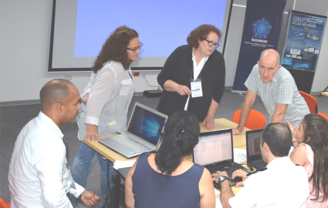
Ned Dwyer discuss story map options with students
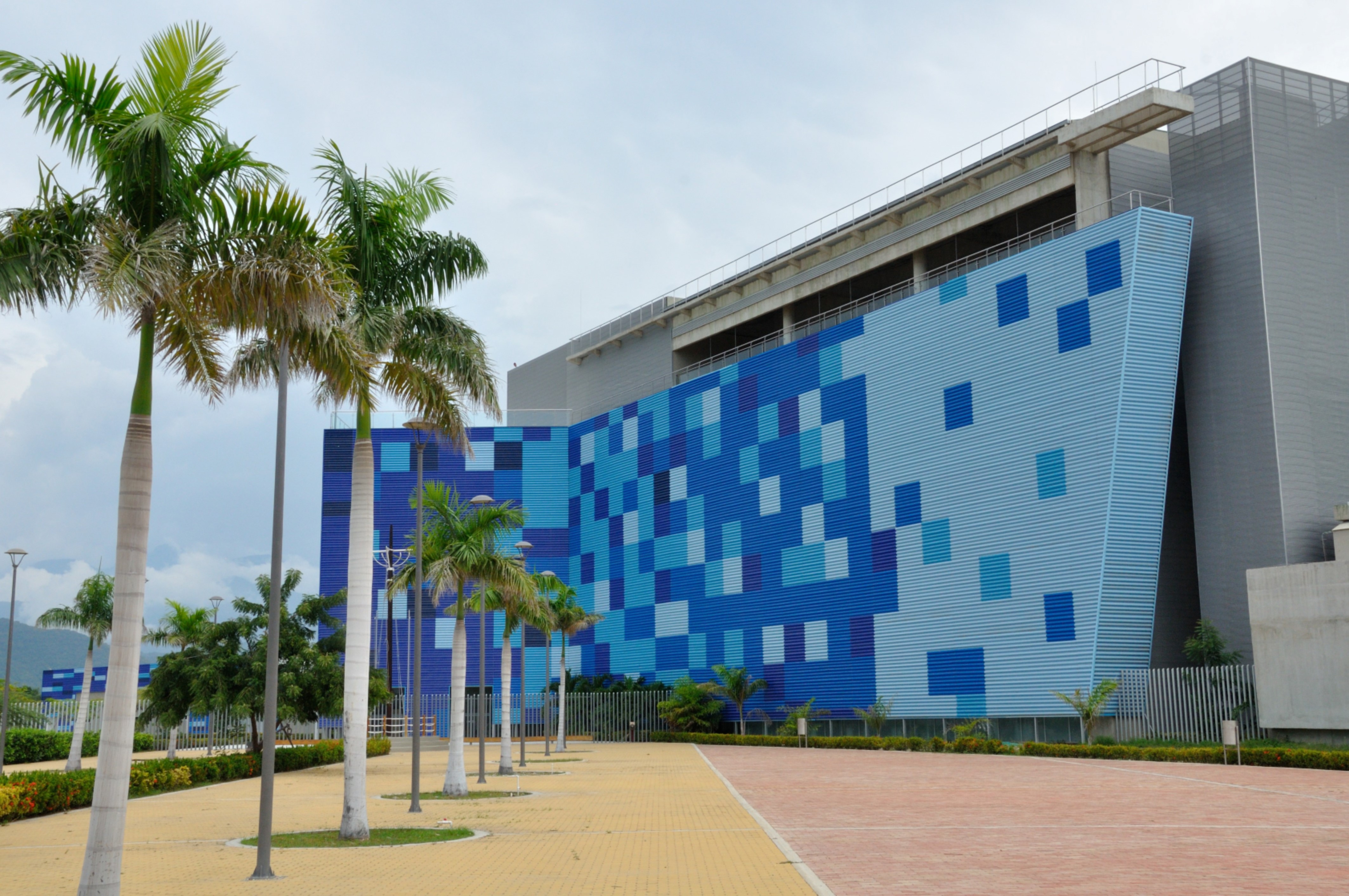
ICAN 8 Coastal Web Atlases – Enhancing Ocean Literacy Santa Marta, Colombia
- Detalles
- Categoría: News News
ICAN Steering Group Meeting
The International Coastal Atlas Network’s Steering Group meet on 11 September hosted by INVEMAR in Santa Marta, Colombia. The morning session met with the current ICAN work plan, some time spent on the strategic planning, and decisions on the future membership of the Steering Group. (See page x for information on the new ICAN Steering Group). The afternoon session was open and included several participants from the Ocean Teacher Global Academy course that started later in the week. The afternoon session dealt with how ICAN can support other IODE projects with reports on the Caribbean Marine Atlas, SPINCAM and the African Marine Atlas.
ICAN 8 workshop Coastal Web Atlases – Enhancing Ocean Literacy
The ICAN 8 workshop Coastal Web Atlases – Enhancing Ocean Literacy was held on the following day, 12 September 2017 starting with the keynote lecture by Francesca Santoro, the ocean literacy lead for the International Oceanographic Commission. Dr. Santoro’s lecture was followed by sessions on Latin American approaches to ocean literacy, coastal web atlases and their role in advancing ocean literacy and technology supporting ocean literacy. Several presentations were made remotely including Marcia Berman’s presentation on Story Maps and Coastal Web Atlases to support Climate Literacy in Virginia and David Hart’s presentation Advancing Great Lakes Literacy through the Wisconsin Coastal Atlas. Marcia and David were unable to attend ICAN 8 in person due to travel delays caused by Hurricane Irma. Other contributed presentations included Quantification of the impacts of tropical cyclones on the coasts of the Gulf of Mexico, the Western Caribbean Sea and on the urban, semi-urban and rural localities of Mexico by Agustín Fernández Eguiarte, Informatics Unit for the Atmospheric and Environmental Sciences of UNAM, Mexico, Science-society interface - From Academic Data to Practical Knowledge concerning Coastal Areas by Dr. Silvia Sartor, Polytechnic School of the University of São Paulo, Brazil, The Sydney Harbour Atlas – Raising awareness of an urban marine ecosystem by Andrew Sherin, Coastal and Ocean Information Network (COIN) Atlantic, Canada. Presentations from Latin America included SPINCAM by Alejandro Iglesias Campos, IOC, UNESCO, Colombian national activities - Paula Cristina Sierra-Correa, INVEMAR and Julian Monroy, CIOH, Colombia’s Oceanographic and Hydrographic Research Center and the Caribbean Marine Atlas 2 by Carolina Garcia Valencia, INVEMAR.
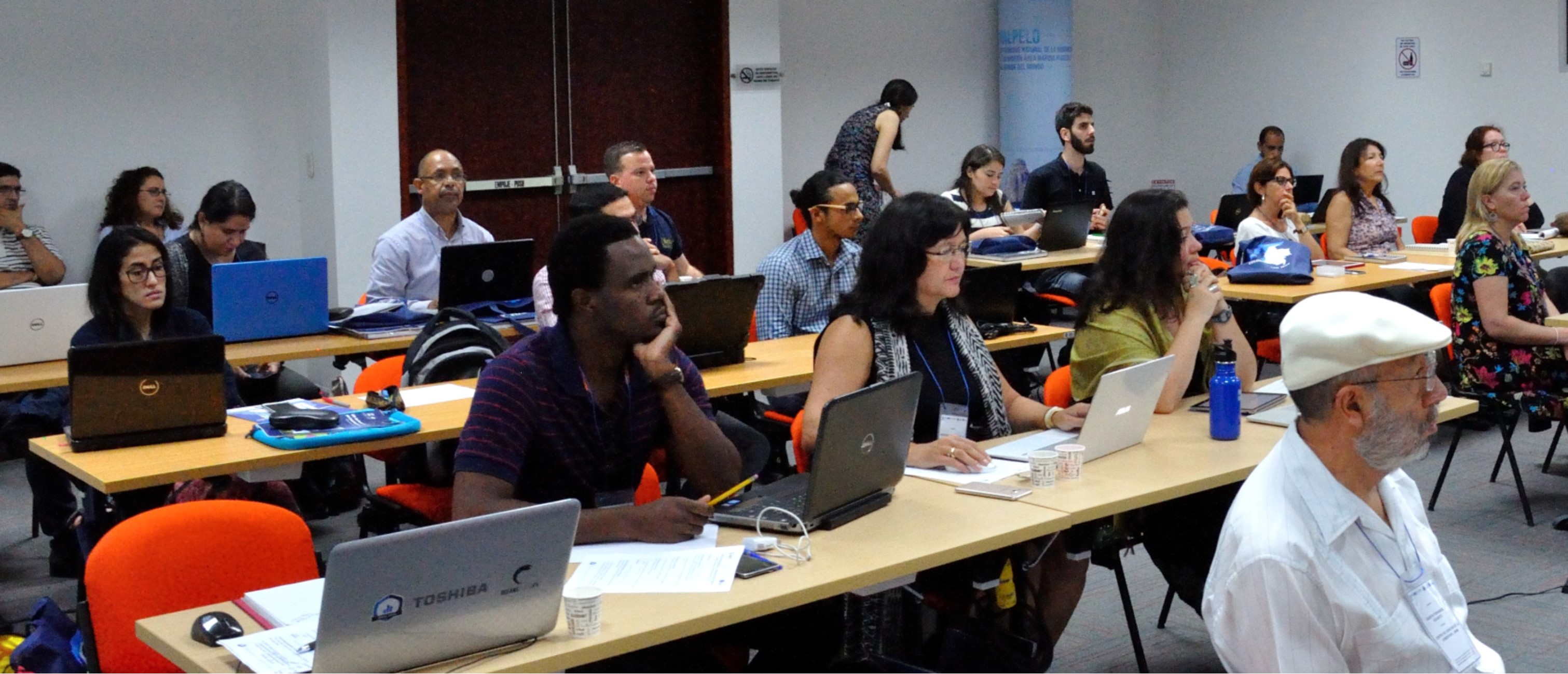
The workshop ended with a tour of the Marine Natural History Museum located at INVEMAR and a tour of the laboratories at INVEMAR.
A Story Map version of the ICAN 8 report is available for viewing at http://arcg.is/2ft3k4Z
ICAN - Best Practice Guide to Engage your Coastal Web Atlas User Community
- Detalles
- Categoría: News News
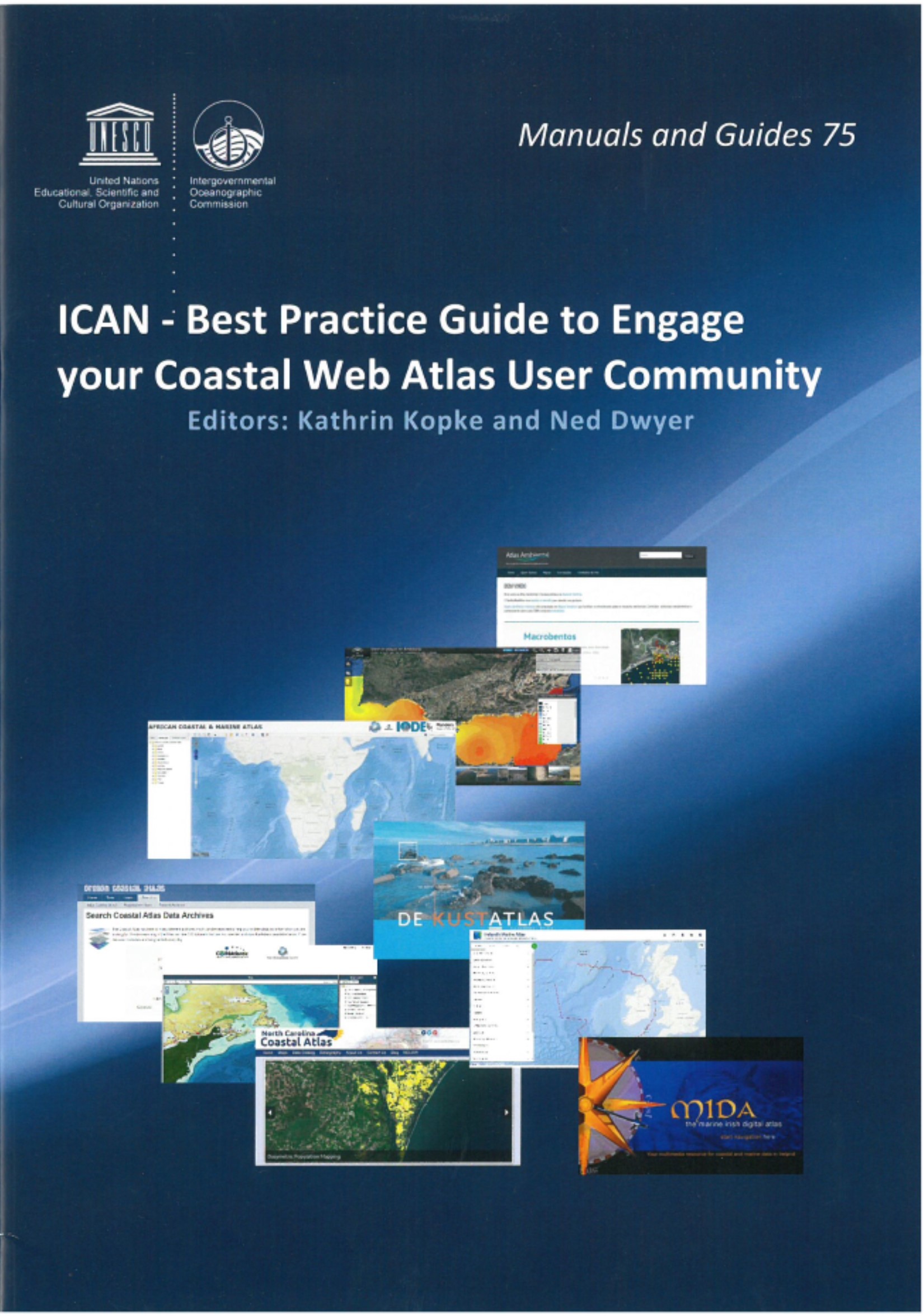 ICAN have compiled this best practice user interaction guide because successful interactions with potential Coastal Web Atlas (CWA) users during the development of any CWA are as vital for the success of the resource as the continued interaction with existing audiences to ensure longevity and continued use. This hand book is conceived as a practical “cookbook” and was compiled by gathering information from ten atlas developers as well as extracting relevant information from ICAN workshop reports. The information has been summarised and analysed leading to two sets of recommendations, one focused on the development of new atlases and the other focused on how to maintain interactions with audiences of already developed atlases. We hope that the handbook will allow both new and established CWA developers and hosts to benefit from best practice examples as well as learn from experienced challenges, in order to increase capacity to successfully interact with user communities and target audiences, while managing coastal and marine data and information in a user friendly way. The final product is a resource that hopes to complement and link to a variety of OceanTeacher activities, support IODE training in courses, thereby being of value to all who manage and present marine data and information.
Now available as IOC Manuals and Guides No. 75:
http://www.oceandocs.org/handle/1834/9579
COINAtlantic Announces the Sydney Harbour Atlas
- Detalles
- Categoría: News News
COINAtlantic has released version 1 of an Atlas for the harbour of Sydney, Nova Scotia, Canada. The Atlas is built on a customized version of COINAtlantic’s Search Utility and displays map layers served from several OGC compliant web mapping services including COINAtlantic’s own WMS service of the data stored in the OBIS Canada Information Publication Tool, and other web mapping services provided by the Province of Nova Scotia and the Government of Canada. The Atlas is intended to display spatial data relevant to an urbanized coastal ecosystem.
The Atlas can viewed at:
http://coinatlantic.tools/csu/?mapset=sydney_harbour
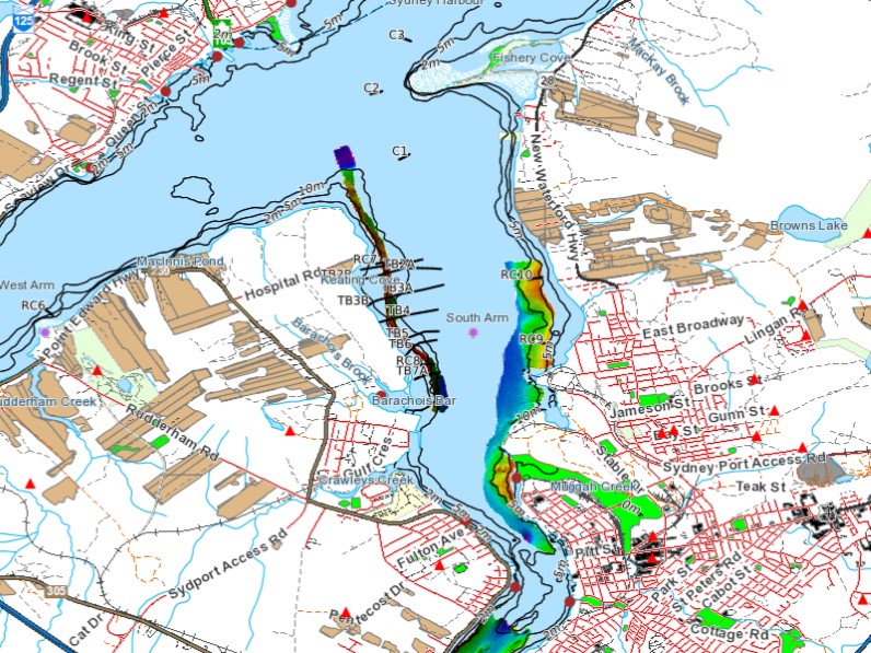
Sample map from the Sydney Harbour Atlas with a partial legend
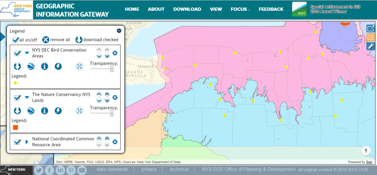
State of New York Gateway: Focus on Data
- Detalles
- Categoría: News News
Gateway Team, Division of Community Resilience and Regional Programs
Office of Planning & Development, New York Department of State
Esta dirección de correo electrónico está siendo protegida contra los robots de spam. Necesita tener JavaScript habilitado para poder verlo.
Focus on Data!
Great Lakes folks, and specifically those in the Lake Erie and Niagara River Watershed, will be pleased to hear that, in partnership with Erie County Environment & Planning, we’ve started adding information from a watershed Atlas they have developed. There are now 14 new datasets related to their mapping effort available on the Gateway with another batch coming soon. These are state-wide and in some instances region–wide datasets that Erie County used in developing their Atlas. You can find the information by simply searching on “Lake Erie”, here is a link to the map viewer with all of the new datasets added to the view: Lake Erie & Niagara River Watershed.
In addition to more Lake Erie & Niagara Watershed data, Long Island Sound-Centric folks should stay tuned for the next Gateway Update…
As always we appreciate suggestions regarding additional geospatial information that you would help you in your work or to understand your world around you.
Download Away!
About two weeks ago some astute users notified us that there were issues with downloading some of the datasets. We identified the issue and it was in effect a “switch” that hadn’t been turned on for datasets that we’ve added since the beginning of the year. This has been rectified and all datasets that are indicated as available for download are now telling the truth! A big Thank You to those who provided us feedback on the bug, keep up the great work!
The Numbers
We had a BIG month in April with some major milestones achieved and surpassed. On Thursday, 27 April, the Gateway exceeded 100,000 pageviews and surpassed 18,000 visits since its launch on 29 September 2015. April 2017 experienced the third highest monthly visitor count out of the 19 months the site has been publicly available, the two higher months were October 2015 (essentially the month of its launch) and June 2016 (when we first sent an eblast about the Gateway out to the local government listserv with over 13,000 recipients).
Social Media
The facebook and Twitter icons at the bottom of Gateway pages link directly to our facebook page https://www.facebook.com/informationgateway/ and twitter account https://twitter.com/NYGateway You can stay up to date on facebook and/or by following our twitter feed. Please like us and share us on fb and retweet! As always, please don’t hesitate to provide feedback on your visit to the Gateway so that we may continue to improve on it’s usefulness and your experience.