News
CMRC and SPINCAM team collaborate on integrating SmartAtlas and SIBIMAP
- Detalles
- Categoría: News News
 Mr. Ali al-Othman, SmartAtlas developer at the Coastal and Marine Research Centre of University College Cork, Ireland spent one week in September 2014 at the offices of the CPPS (Comisión Permanente del Pacífico Sur) in Guayaquil, Ecuador, from where the SPINCAM project is co-ordinated. Ali worked closely with Mr. Steve Erique and other CPPS staff on demonstrating recent upgrades to the SmartAtlas, web-GIS system including a Spanish language interface and map print functionality. SmartAtlas is being used to implement the SPINCAM regional atlas. Work also took place on integrating the SIBIMAP database - an information system on marine biodiversity and protected areas in the southeast Pacific – with SmartAtlas. SmartAtlas is an opensource development and is available for use by ICAN members. Contact Esta dirección de correo electrónico está siendo protegida contra los robots de spam. Necesita tener JavaScript habilitado para poder verlo. for further details.
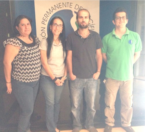
From left to right, Ms. Monica Machuca (Biologist, currently working as an intern in CPPS, supporting the implementation of new layers for the SPINCAM project), Ms. Veronica Avila, (Assistant for the CPPS's Regional Action Plan for the South East Pacific Office). Mr. Ali al-Othman (Computer Scientist and SmartAtlas Developer, CMRC ) and Mr. Steve Erique (IT System Developer and SPINCAM regional atlas coordinator, CPPS).
COINAtlantic: Measuring Progress for Data Accessibility
- Detalles
- Categoría: News News
COINAtlantic is searching for data providing organizations willing to participate in a pilot project to use and give feedback on a Data Accessibility Self-Assessment Tool. The tool is for use in data providing organizations to develop a benchmark to monitor progress in improving the organization’s policies and procedures for providing effective and easy access to the data and information held by them. The data accessibility principles used in the tool is an aggregation of four documents: the Organisation for Economic Co-Operation and Development’s Principles and Guidelines for Access to Research Data from Public Funding; the Government of Canada’s Operating Principles for the Open Government site; the United States Memorandum on Open Data Policy; and the G8 Charter for Open Data . The 11 principles are shown in the Table 1.
Table 1 Data Accessibility Principles |
| 1. Open Data by Default |
| 2. Completeness |
| 3. Primacy |
| 4. Timeliness |
| 5. Ease of Physical and Electronic Access |
| 6. Non-discrimination |
| 7. Licencing |
| 8. Permanence |
| 9. Usage Costs |
| 10. Supporting Use |
| 11. Evaluation |
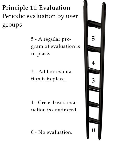
For each principle one or more evaluation ladders have been developed with questions designed to assist the user in positioning their organization’s policies and procedures on the ladder. A sample evaluation ladder for the Evaluation Principle is shown below.
Following the pilot project, the feedback from the data providing organizations that used the tool will be incorporated. If you would be willing to test out this self-assessment tool and share your scores and comments with COINAtlantic, contact Andy Sherin Esta dirección de correo electrónico está siendo protegida contra los robots de spam. Necesita tener JavaScript habilitado para poder verlo. Reporting on the use of the tool will not divulge the source of any scores shared with COINAtlantic.
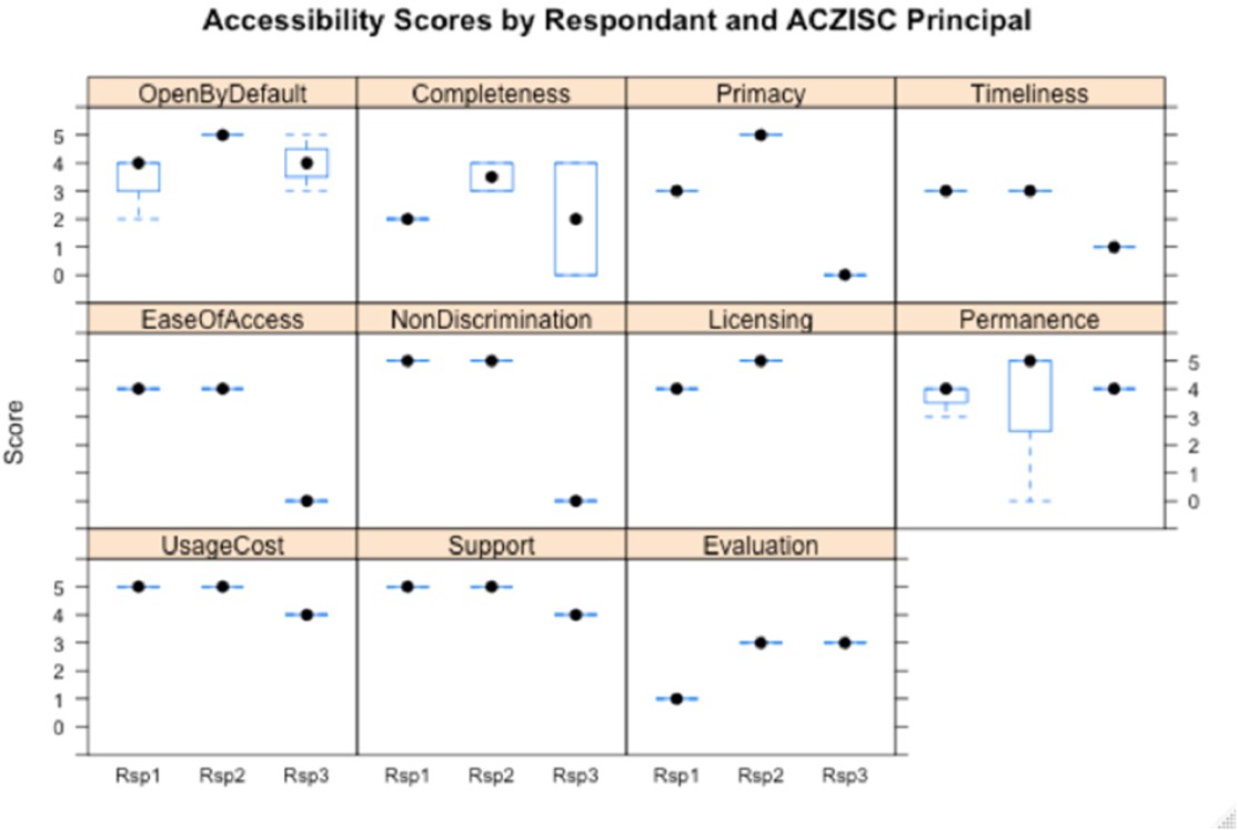
The principles with boxes indicate the spread in scores for principles with more than one evaluation ladder
e.g. Completeness has a ladder for metadata and the data itself
Graphics prepared by Robert Branton, Emeritus Scientist, Ocean Tracking Network
Funding for the development of the tool came from the Adaptation Platform, Natural Resources Canada.
OceanWise offers WMS of IMO Adopted Areas
- Detalles
- Categoría: News News
OceanWise, the independent marine data management and publishing specialist, has recently included Traffic Separation Schemes (TSS), Particularly Sensitive Sea Areas (PSSA) and other International Maritime Organisation (IMO) adopted areas in its marine mapping dataset, Marine Themes. The areas are available in GIS compatible file formats and as an OceanWise hosted OGC compliant web service making the data ideally suited for inclusion in web based coastal and marine atlases and similar systems.
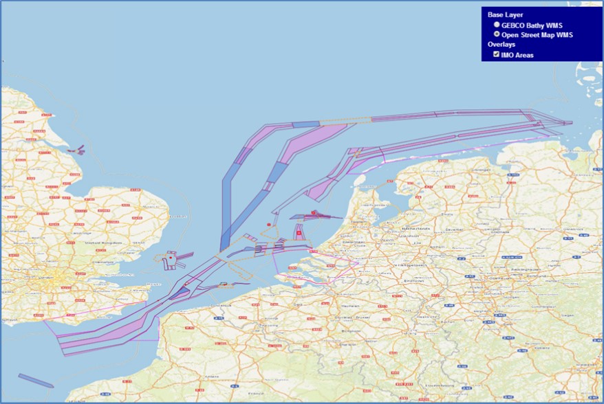
The IMO adopted area datasets are captured from approved IMO documentation and converted into GIS compatible formats under license. The dataset is normally updated within 5 working days of proposed new or amended areas being published and are therefore available to value added publishers and end users as soon as they are adopted.
In addition to incorporating the IMO adopted areas into Marine Themes, OceanWise has launched an OGC compliant Web Map Service (WMS) for the data. The IMO Areas WMS contains worldwide data and can be read directly into most desktop and web based Geographic Information Systems (GIS). It is ideal for organizations, including progressive Hydrographic Offices, wishing to access definitive source data rather than legacy datasets that have been captured from paper charts. The image shows OceanWise’s IMO Areas WMS in conjunction with OpenStreeMap, although other base maps, such as the GEBCO worldwide bathymetric dataset, OceanWise’s ENC WMS and of course Marine Themes itself are also available.
For more information contact Esta dirección de correo electrónico está siendo protegida contra los robots de spam. Necesita tener JavaScript habilitado para poder verlo.
Scotland’s National Marine Plan interactive continues to grow
- Detalles
- Categoría: News News
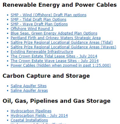
National Marine Plan interactive is about to reach 400 layers. This represents a huge data resource for marine planning stakeholders, available on their own PC. We have come a long way in the last few years in making data available on-line.
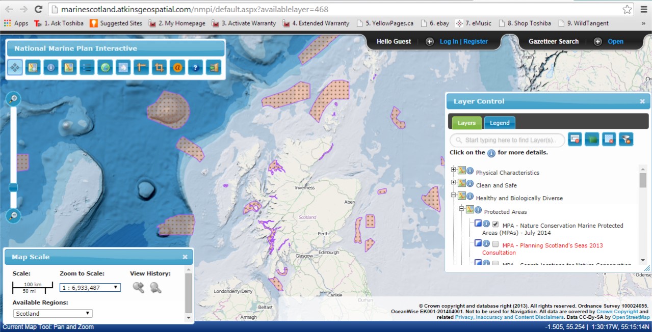
 New data layers continue to be added and amongst recent layers are the ‘Marine Protected Areas’ designation and ‘Draft Special Protection Areas’ made in July 2014. Also, all the draft National Marine Plan maps, on which Marine Scotland consulted last year, can now be found in a new section called ‘Draft National Marine Plan – 2013’ as an archive of the spatial data in the draft plan. Updated data sets for these maps will be added to NMPi.
If you would like a url to a specific data layer to use in documents (which will open NMPi with that data layer turned on), you can obtain these from a new feature - List of available layers (copy the short cut under the hyperlink).
Marine Scotland continues to work with its partners Scottish Environmental Protection Agency (SEPA), Scottish Natural Heritage (SNH), Joint Nature Conservation Committee (JNCC), the Marine Alliance for Science and Technology Scotland (MASTS) and the emerging regional marine planning partnerships, to develop layers that will be relevant and valuable for both national and regional marine planning.
Feedback on NMPi is always welcome and can be e-mailed to Esta dirección de correo electrónico está siendo protegida contra los robots de spam. Necesita tener JavaScript habilitado para poder verlo.
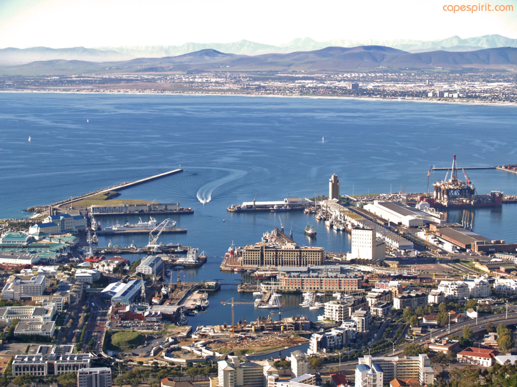
CoastGIS 2015: 12th International Symposium for GIS and Computer Cartography for Coastal Zone Management 22-24 April 2015 Western Cape, South Africa
- Detalles
- Categoría: News News

The 12th International Symposium for GIS and Computer Cartography for Coastal Zone Management (CoastGIS 2015) will take place in the Western Cape, South Africa, from April 22-24 2015. This event will be held back-to-back with 7th meeting of the International Coastal Atlas Network (ICAN).
The Symposium theme “Rich Data, Poor Data: Geospatial Creativity and Innovation for Managing Changing Coastal Systems” refers to the increasing demand on decision-makers and managers to be aware of changes in the coastal and marine environment. Not only must there be a much greater emphasis on the measuring of change, but also increasing and creative options for data poor and rich environments alike, to act on the observed changes, which may have either positive or negative societal impacts. In other words, how can CoastGIS 2015 contribute to the understanding of coastal change, and how can the powerful tools we use, as a scientific and management community; help us make better decisions, especially in data-limited environments? Can we demonstrate how the excellence, passion and creativity in the various disciplines encompassed by CoastGIS be used to improve the use of science for decision-making relating to coastal management?
Planned sessions include:
- Analysing and modelling coastal and marine processes
- Spatial information and observation systems
- Coastal risk and vulnerability
- Advances in data visualization
- Advances in geographical information technologies
- Decision-support and spatial planning
- Innovative application of geospatial technologies in coastal environments
- Coastal mapping and monitoring
- Coping with data scarcity in coastal and marine management
- Coastal and marine spatial data infrastructure (SDI)
- Application of geospatial technologies to support climate change adaptation in coastal regions
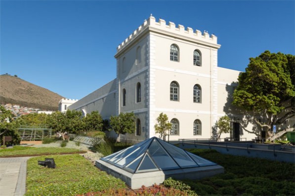
Abstract submission for the CoastGIS2015 Symposium is open and instructions on how to submit an extended abstract can be found on the website at www.coastgis2015.co.za. The abstract submission deadline is 24 October 2014. The Symposium venue is the Protea Hotel Breakwater Lodge near the Cape Town waterfront and in the shadow of icon Table Mountain. The City of Cape has many accommodation options, a vibrant inner-city social scene with numerous restaurants, bars and cafes.

The CoastGIS2015 local organising committee and international scientific committee would love to welcome you to Cape Town in April 2015. Please contact Louis Celliers (Esta dirección de correo electrónico está siendo protegida contra los robots de spam. Necesita tener JavaScript habilitado para poder verlo.) for more information.