News
ICAN 7: Coastal Web Atlases – Supporting Ecosystem Based Management
- Detalles
- Categoría: News News
 The ICAN 7 workshop will take place in beautiful Cape Town, South Africa on April 19-20, 2015 just before the CoastGIS conference. The focus this year is on how coastal web atlases can support ecosystem based management.
If you would like to present a paper on your atlas development or usage experiences in relation to the activities below, please send a title and a brief (approx. 250 word) abstract before 31 October 2014 to Ned Dwyer (Esta dirección de correo electrónico está siendo protegida contra los robots de spam. Necesita tener JavaScript habilitado para poder verlo.) or Marcia Berman (Esta dirección de correo electrónico está siendo protegida contra los robots de spam. Necesita tener JavaScript habilitado para poder verlo.) for consideration by the workshop organising committee.
Looming large and welcoming you to
Cape Town, is the iconic Table Mountain
Photo: Cape Town Tourism
Key activities at the ICAN-7 workshop will include:
- exploring the opportunities for CWAs to address the objectives of managing and protecting LMEs;
- discussing the challenges of Atlas development and usage in the African Atlas community;
- sharing knowledge and experience on approaches to data licencing and data sharing in order to make data holdings more visible;
- a session on “interoperability for dummies” which aims to demystify coastal atlas interoperability and highlight the benefits; and
- a small “workshop within a workshop” for atlas technical developers on how to become a new node in the ICAN interoperability demonstrator, using the updated cookbooks
- development of an ICAN work plan for the period 2015-2017.
- Face-to-face meeting of the ICAN Steering Group
This workshop follows on 2013’s successful workshop ICAN 6: Expanding Participation in Coastal Web Atlas Development and Use”, held at the University of Victoria, British Columbia, Canada, as well as five previous workshops held in 2006, 2007, 2008 and 2009 and 2011.
A range of accommodation options in the Stellenbosch area are available. More information here soon.
ICAN 7 is co-organized by Ned Dwyer Eur-Ocean, Kathrin Kopke of the Coastal and Marine Research Centre, Ireland; Lucy Scott, United Nations Development Programme- Global Environment Facility, South Africa; Louis Celliers, Council for Scientific and Industrial Research, South Africa; Marcia Berman, Virginia Institute of Marine Science, USA; Alejandro Iglesias Campos, UNESCO-IOC (Intergovernmental Oceanographic Commission). The ICAN 7 workshop is sponsored in part by IODE.
Information on reaching Stellenbosch and the venue will be posted here soon
Organizers and Sponsors ICAN 7
ICAN 6: Report now available
- Detalles
- Categoría: News News
Ned Dwyer,
Kathrin Kopke
The full report on the ICAN 6 workshop held in June 2013 is now available on the ICAN website at: http://www.oceandocs.org/handle/1834/6612. Here is a sneak preview of the Executive Summary.
From June 16th to 17th, 2013, the International Coastal Atlas Network (ICAN) held a workshop on “Expanding Participation in Coastal Web Atlas Development and Use”, at the University of Victoria, British Columbia, Canada. The workshop (aka “ICAN 6”) engaged 29 participants from 9 countries, representing 22 organizations and multiple areas of scientific and technical expertise. This meeting was a follow-up to the successful 2011 workshop on “Coastal Atlases as Engines for Coastal & Marine Spatial Planning” (aka “ICAN 5”) held in Oostende, Belgium, as well as workshops in 2009, 2008, 2007 and 2006.
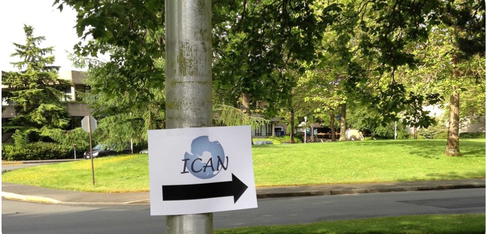
Follow the sign to find out more about ICAN 6
ICAN 6 provided an opportunity to discuss how the ICAN community could take advantage of now being an IODE project to share its knowledge and aid capacity building among IOC member states in relation to coastal and marine data management. Moreover, ICAN has seen its membership grow in the last two years and given its extensive membership along the North and South American Pacific coasts it was a great opportunity to hear about atlas developments in those regions.
Key activities at the workshop included:
- exploring the opportunities for ICAN in an IODE context and how to build synergies with other IOC projects; the activities of the Ocean Biogeographic Information System (OBIS) project of the IOC were presented as well as IOC’s ICAM programme which highlighted how data management tools developed within ICAN can contribute to the goals of ICAM. Beyond the IOC, activities within the Group on Earth Observations’ (GEO) Coastal Zone Community of Practise (CZCP) are very relevant to ICAN, in particular the objective to develop a global coastal zone information system (CZIS). ICAN can help inform the development of such a CZIS
- discussion of coastal atlas training needs and how ICAN members can contribute; in particular the training requirements of the African Coastal and Marine Atlas, and the Caribbean Marine Atlas were discussed. An overview of IODE training activities was presented and linkages on training between ICAN and ICAM related projects (e.g. SPINCAM II) were discussed. ICAN should also take advantage of the OceanTeacher platform developed by IODE
- Atlas Stories – presentations from Atlas developers and users from North and South American Pacific coasts and beyond; the ICAN 6 Atlas Stories focused on CWA development around the Western Pacific Rim presenting new activities as well as updating the network on recent upgrades to previously discussed CWAs. The session started with the South American SPINCAM project which is developing atlases across five countries, followed by updates on the Oregon Coastal Atlas and the Washington State Coastal Atlas. Workshop participants also learned about Canada’s CanCoast and ShoreZone and the session concluded with the introduction to SmartAtlas through the African Coastal & Marine Atlas Experience
- a small “workshop within a workshop” for atlas technical developers on how to become a new node in the ICAN interoperability portal, version 3; The latest version has multilingual search capability, semantic search and the ability to connect directly to map services and display the results in a map. It was agreed that the current interface will be upgraded to HTML5 in the coming period
- a small “workshop within a workshop” focussing on Volunteered Geographical Information (VGI) and its implications for coastal atlases; within the EEA, systems have been developed using both crowdsourcing and citizen science approaches. SeaSketch is a software platform intended as an end-to-end mapping solution for marine spatial planning, which allows anyone, regardless of their technical abilities, to sketch prospective management plans and receive analytical feedback on the consequences of their designs. The Marine Regions project aims to develop a standard for georeferenced marine names and there is potential to link it to the ICAN portal. Esri is introducing the concept of a “living Atlas” which is delivered via ArcGIS Online (AGOL). ICAN members can take advantage of this concept by using it to leverage their existing Atlas holdings or by using the platform to build a new Atlas quickly
- development of an ICAN work plan for the period 2013-2015; this included plans for developing a communications strategy, a handbook on how atlas developers and users can interact and building synergies with other IOC and non-IOC projects. It also looked at developing a coastal atlas training plan. At its core ICAN supports atlas development and interoperability approaches, therefore the Technical Committee presented its plans for developments in the next two years.
The workshop concluded with the first face-to-face meeting of the new Steering Group, which was put in place after ICAN became an IODE project. This meeting saw two new members join the SG and appointed leads to the various work plan elements.
Since ICAN 6 there have been developments in relation to the work plan. A revised plan and associated budget request was submitted to the IODE Officers meeting held in March 2014. As IODE has a limited budget and a number of projects to support, not all work plan items will receive funding, however the funding allocated will be of significant assistance to maintain ICAN and help progress its work. ICAN is now on a sound footing as part of the IODE family of projects, although members should continue to seek funding from other sources to advance the key technical activities. This ambitious work plan will require the commitment of all members to ensure that it can be implemented. A priority for 2014 is the redevelopment of the web site in order to make it easier to navigate and more responsive to user needs. Interoperability remains a core activity of ICAN and the technical committee has proposed a number of activities to progress further the developments in this area. A key technical concept which emerged at ICAN 6 was that of an “atlas-in-a-box”. The idea is that a new atlas developer can get started quickly on implementing and publishing a CWA with a minimal amount of technical/programming knowledge. The committee intends to scope the feasibility of such a development based on potential solutions such as SmartAtlas and ArcGIS Online.
We would like to thank Rosaline Canessa and her team at the University of Victoria for their warm welcome and excellent hosting of ICAN-6 and we look forward to seeing you at the 7th International workshop (aka “ICAN 7”) which will be hosted in South Africa from 20-21 April 2015 just before CoastGIS 2015.
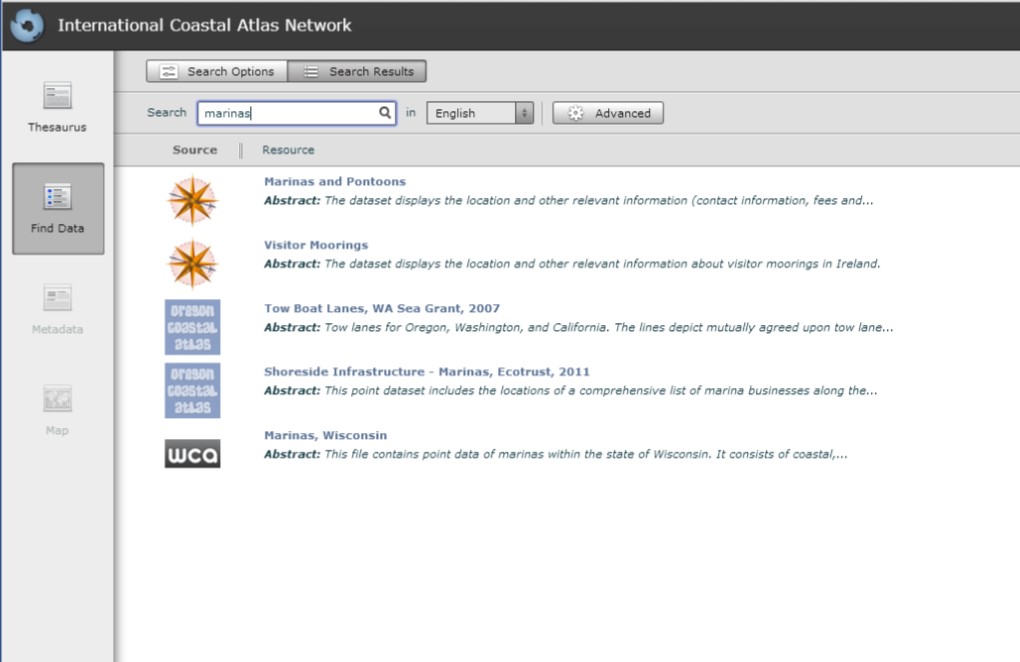
The Wisconsin Coastal Atlas: Helping Build a Coastal Spatial Data Infrastructure
- Detalles
- Categoría: News News
The Wisconsin Coastal Atlas (http://wicoastalatlas.net/) is a web resource that helps people better understand coastal issues, share coastal data, and inform decision-making about sustainable use of the Great Lakes. It is intended for use by coastal resource managers, planners, researchers, educators, tourists, and citizen scientists and builds on many years of collaboration between the University of Wisconsin Sea Grant College Program and the Land Information and Computer Graphics Facility at the University of Wisconsin-Madison to leverage the sizeable investment in local government land information systems and apply geospatial technologies to address Great Lakes issues.
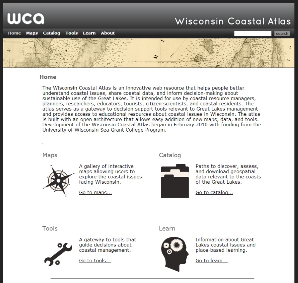
The Wisconsin Coastal Atlas (WCA) is modeled after the Oregon Coastal Atlas (http://coastalatlas.net/) and organized into four sections: maps, catalog, tools, and learn. A gallery of interactive maps provides customized perspectives related to specific coastal issues in Wisconsin. An example is the Fox-Wolf Hydrologic Dashboard, which visualizes the spatial pattern of large precipitation events and the resulting impacts on streamflow. The catalog section of the atlas provides several paths to discover, assess, and download geospatial data for the Great Lakes coasts of Wisconsin. At the center is a simple data download matrix based on the open data catalog at the City of Vancouver, British Columbia. Finally, the atlas serves as a gateway to spatial decision support tools relevant to Great Lakes management and provides access to educational resources about coastal issues in Wisconsin.
The WCA, however, is more than just a web portal that provides access to coastal data and tools – it is also a research project that is helping to build a coastal spatial data infrastructure for Wisconsin. Since February 2010, the project has tackled several research topics, including: 1) structured design and evaluation of web atlases; 2) guidance on making choices among different web mapping technologies; 3) promotion of sound cartographic design principles for web mapping interfaces; 4) development of effective archives for coastal geospatial data; 5) application of ontology tools to promote semantic mediation of local government spatial data sets to conduct spatial analyses of coastal issues at a regional scale; and 6) advancing social science methods to improve the effectiveness of coastal decision support tools. The primary motivation is demonstrating that the atlas can serve as an interoperable resource that both integrates local geospatial data for coastal management in Wisconsin and can serve as a component of a larger networked Great Lakes Coastal Atlas.
One way to demonstrate the WCA as an interoperable resource is through participation in the ICAN Prototype (http://ican2.ucc.ie/atlas/). A key technologies that supports the WCA is GeoNetwork (http://geonetwork-opensource.org/) - an interoperable geospatial metadata catalog that supports the Catalogue Service for the Web (CSW) standards developed by the Open Geospatial Consortium (OGC). A total of 57 geospatial data sets are documented and accessible through the WCA GeoNetwork. With the assistance of Yassine Lassoued, Roy Lowry and Tanya Haddad, the Wisconsin project team followed the steps in the ICAN semantic interoperability pilot cookbooks developed as part of the NETMAR project (http://netmar.nersc.no/) to connect to the ICAN Prototype. The result is the ability to search for Wisconsin coastal data as part of a global network of coastal atlases.
In an effort to share research findings, papers completed as part of the WCA project are available for download in the “About” section of the atlas. This includes two white papers that may be of interest to the ICAN community:
Bibliography
- Sack, Carl and Tim Wallace. 2012. Tools and Best Practices for Coastal Web Maps
- Sack, Carl. 2013. User-Centered Design for Coastal Web Atlas Maps and Tools: A Process Manual
COINAtlantic Search Utility Enhanced
- Detalles
- Categoría: News News
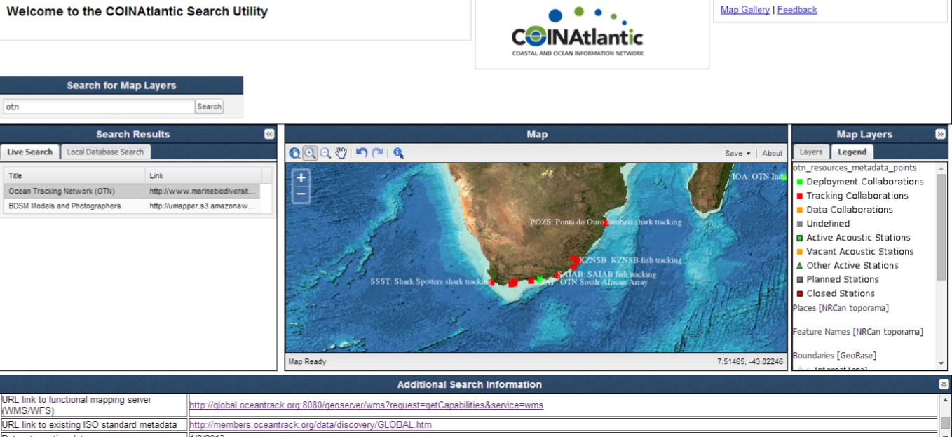
The Atlantic Coastal Zone Information Steering Committee’s (ACZISC) COINAtlantic Search Utility (CSU) has received a number of enhancements. The CSU searches the internet using the Google Custom Search API for web mapping services (WMS) and KML spatial resources that meet the search criteria entered by the user. The user can then chose to add the resulting resources to the map and save the map as an image, pdf or Geotiff.
The CSU enhancements include:
- The speed of loading the application has been improved by reducing the size of Java script libraries;
- A web mapping service can now be added to the map directly from the “URL link to functional mapping server” field found in the metadata display at the bottom of the CSU window (see red box in the figure above for the WMS provided by the Ocean Tracking Network);
- The CSU now uses the GetLegendGraphic feature of the WMS standard to display a legend for an added spatial resource;
- The CSU maintains a local data base of discovered spatial resources that can also be searched using the “Local Database Search” tab. When the “Add WMS layer” feature of the CSU is executed manually by the user, the URL and abstract metadata for the added WMS layer is added to the local database.
Thusly, the local database grows with the use of the CSU, accumulating the results of searches and the manual entries of WMS.
The metadata displayed at the bottom of the figure above was generated by the COINAtlantic GeoContent Generator (CGG), a web-based application, that captures ‘bare bones’ discovery metadata and integrates it with a graphic KML (i.e. point, line, or polygon) that describes the geography the entry is relevant to. The KML can be chosen from a library of KML templates, drawn by hand, or uploaded. The CGG then publishes the KML to the internet and facilitates its discovery by the Google search engine.
Further enhancements are planned including enabling the local database to respond to CSW requests and the CSU search to query CSW-compatible metadata catalogs in addition to the present search of the internet.
The new version of the CSU will be released to coincide with the COINAtlantic Training Workshop to be held on 20 June 2014 just after the Coastal Zone Canada 2014 conference being held in Halifax, Nova Scotia, Canada from 15-19 June 2014. The workshop will not only familiarize participants with the use of the CSU and the CGG, but Jeff McKenna of Gateway Geomatics will take participants ‘under the hood’ and introduce the Open Source components used to build the tools. Follow @coinatlantic for the announcement of the new version of the CSU.
CSW, ontology webinar and SmartAtlas Workshop
- Detalles
- Categoría: News News
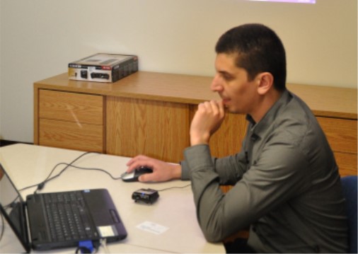
A webinar on CSW, semantics and ontologies was sponsored by COINAtlantic and followed by a workshop on SmartAtlas 21-22 May 2014 in Halifax. The agenda included an Introduction to OGC and CSW by Jeff McKenna, Gateway Geomatics and a member of OGC, the ICAN CSW mediator by Yassine Lassoued (CMRC), ISO ontology initiatives by Jean Brodeur, Natural Resources Canada, Ontology research at Memorial University by Arnaud Vandecasteele, and ICAN ontology development again by Yassine. The presentations and video will be posted on www.coinatlantic.ca Follow @coinatlantic to find out when they will be available.
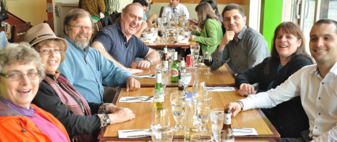
(from the right) Arnaud Vandecasteele (Memorial University), Lenore Bajona (Ocean Tracking Network OTN),
Yassine Lassoued (CMRC), Jeff McKenna (Gateway Geomatics), Bob Branton (OTN), Shirley Sangster and Sheila Clyburne