Juan Antonio Bermejo Domínguez,
Observatorio Ambiental Granadilla (OAG),
Edf. Puerto Ciudad, oficina 1ºB,Santa Cruz de Tenerife, Spain
e-mail: This email address is being protected from spambots. You need JavaScript enabled to view it.
 The aim of the Integrated Marine Data Repository for Macaronesia (REDMIC) is to provide a permanent system for systematic storage, custody and service of marine data of the Canary Islands and, by extension, the Macaronesian Region (Azores, Madeira, Cape Verde & Canary Islands). The repository is configured as an open system of integrated geographic information suitable for searching, viewing, downloading, and data analysis. REDMIC is presented as database capable of covering all areas. Data, whatever their nature, are bounded by the activity that generates them and grouped by type of activity, with total freedom to define them. Using a common data model (ArcMarine) allows to develop analytical functionalities based in any data hosted, no matter their origin. This achievement will serve the research community, interested citizens, marine user-groups, local planning and management authorities and it will support as well the policy actions derived from the Habitat Directive, Water Quality Directive and Marine Strategy Directive. The Macaronesian region in the NE-Atlantic, aims to be integrated in the Marine Data Infrastructure of Europe, and supports the provisions of Directive 2007/2/EC INSPIRE. Moreover, as pilot-project, it could become an attractive operational model that can be replicated in other marine regions (Pacific, Caribbean, etc.)
REDMIC is currently in second phase of development, centred on programming several modules and feeding data in parallel. The specific objectives at present are the following:
- To develop the software to facilitate data handling (adding, editing, transfer, user –friendly interfaces, etc.)
- To incorporate basic administrative data (protected areas, institutions, etc.) and feeding marine data for the Canary Islands and Madeira Archipelago as a continuous process.
- To establish coordination protocols between Regions in order to share and work simultaneously with REDMIC, and train technicians to run the different modules.
- To disseminate the goals, scope, and usefulness of REDMIC.
REDMIC is conceived as a perpetual service provided by the Observatorio Ambiental Granadilla (OAG) and based at its Data Center in Santa Cruz de Tenerife, Spain. It aims to eventually become an official repository for public marine data.
Module development
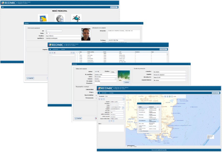
The OAG has already made a significant effort acquiring hardware and standard software to support the Marine Data Repository. However, in order to run the Repository in an integrated manner according to the ArcMarine conceptual framework, there is a need for considerable programming, namely, the development of specific modules that allow user-friendly incorporation of data into the system, handling metadata (institutions, platforms, sensors, parameter descriptions, etc), quality assessment procedures, etc. The following is a summary of the modules to be developed:
- Administrative module (business tables):
- Chorologic module
- Biotic surveys module
- Tracking module
- Time series & instantaneous data management module
- Taxonomic module
- Reference management module
Data types
 REDMIC is presented as a single database capable of covering all areas. Data, whatever their nature, is bound by the activity that generates them with total freedom to define them and are grouped by type of activity. Using a common data model allows the development of analytical functionalities with access to any data whatever activity has generated it. Data within the REDMIC can be of different natures, considering the multiple variables and environmental parameters interrelated in the marine ecosystem. A systemic analysis of data and metadata relevant to the repository is as follows:
a) Marine climatology
b) Physical oceanography
c) Chemical oceanography
d) Biodiversity
e) Archaeology
f) Environment
g) Political and administrative data
h) Infrastructure
i) Use of resources
j) Navigation and incidents
k) Images & remote sensing

ArcMarine Logical data model
REDMIC it is based on the ArcMarine data model, and client-server architecture in a distributed system, which consists of clients seeking services and a server responding to requests. To optimize the process of adding data to REDMIC, the OAG will develop an web interface software (several modules) using php and javascript. The application will works on the management system database PostgreSql and has integration with ArcGIS Server 10 for the management, analysis and maintenance of geo-referenced data. Integration with ArcGIS Server will be done through the framework developed by ESRI Web Dojo. The OAG has already developed some interface prototypes, like the chorologic module, which is ready to be used and tuned-up. We adopted web technology because it provides universal access to applications through predefined user roles, making the REDMIC ubiquitous.

The User Geoportal
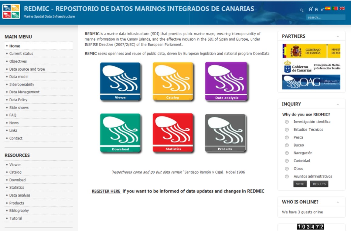
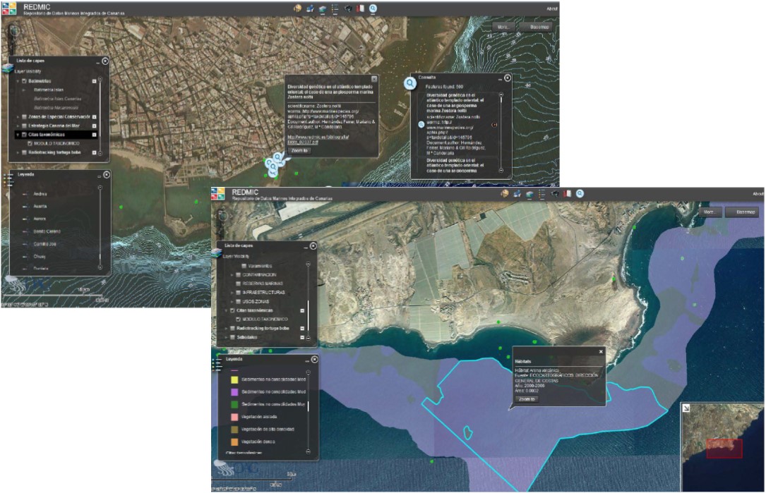
REDMIC has a website (http://www.redmic.es) which is essential to fulfilling its objectives of public access to information and data, as well as the best way of making itself well-known. The user geoportal is the initial window of access to REDMIC, showing all the possibilities offered by this service. Most of them are not yet developed, but existing information has been included to test accessibility and disseminate REDMIC existence and goals. The user can choose the "Viewer", "Downloads" or "Analysis" entry buttons, as well as the “Catalog”. Simple and intuitive searching and selecting data is common to these modules. Within the window of "Products" the user can download the result of tests carried out or some finished work of general interest. The provision of basic or developed information can be as wide as the data stored in the REDMIC allow. It is logical to concentrate on that for which there is some demand, for example:
- Sea conditions (wind, waves, temperature)
- Species distribution
- Marine protected areas
- Concentration of pollutants in coastal areas
- Whale watching areas
- Fishery regulated areas
- Distribution of sea-grass meadows
- Bathing condition maps, etc.

