
Maryland’s Coastal Atlas is an online mapping and planning tool that allows state and local decision-makers to explore and analyze data for coastal and ocean planning activities. In January 2015 the Maryland Department of Natural Resources’ Chesapeake and Coastal Service updated Maryland's Coastal Atlas to Version 2.0.
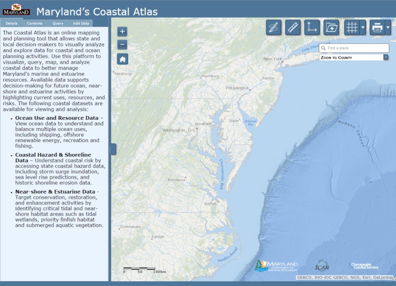
The Coastal Atlas provides access to data on physical characteristics, human uses, and ecological resources for our ocean, shoreline, near-shore, and estuarine areas. Datasets are provided by a number of partners, including Maryland Department of Natural Resources, the Maryland Energy Administration, Towson University, the University of Maryland, The Nature Conservancy, the Mid Atlantic Regional Council on the Ocean (MARCO), and the National Oceanic and Atmospheric Administration. In addition to coastal datasets, online tools have been developed to support better decision-making and help concerned citizens address specific coastal issues.
 Chesapeake and Coastal Service staff worked in concert with our Geospatial Analysis and Targeting Division and staff from Maryland’s Department of Information Technology to update the Coastal Atlas and prepare it for the coinciding 1 January 2015 launch of MD iMap 2.0. A new MD iMap 2.0 web template provides Maryland’s abundant state mapping tools and services with a consistent design and provides a more user-friendly environment .
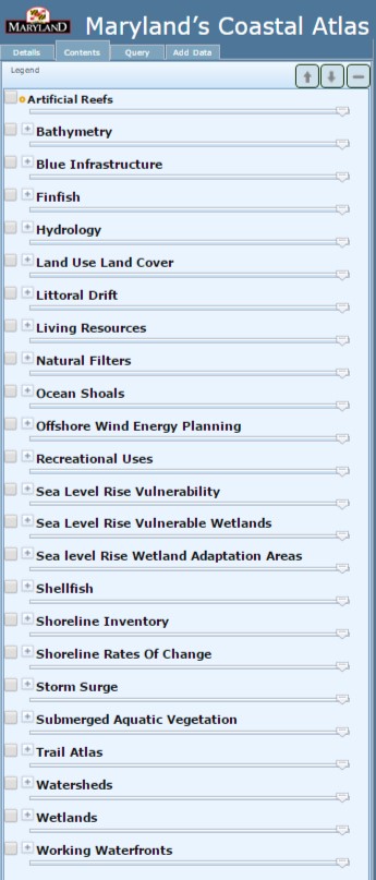
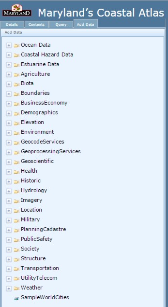
Besides the fresh look and larger mapping area, one of the most noteworthy changes to the Coastal Atlas is the location and organization of the data layers. Coastal Atlas data is no longer separated into individual thematic mappers (Ocean, Estuaries, and Shorelines). All State coastal data is now organized alphabetically along the left menu bar, under the "Contents" tab. Layers most commonly pulled in as web map services from other portals (e.g. the MARCO Portal, NOAA Digital Coast, and National Marine Cadastre) can be found within the "Add Data" tab in thematic folders such as "Oceans ".
 In conjunction with these updates, DNR’s Chesapeake & Coastal Service is seeking user input about the efficacy and usefulness of the new Coastal Atlas 2.0, as well as experiences with version 1.0. We are also eager to capture examples about how Coastal Atlas data and tools are being utilized. To gather this information, we have created a simple 20 question survey that will help inform future Coastal Atlas improvements. We encourage all users of the Coastal Atlas to help us make it better and provide better data by completing the survey at https://www.surveymonkey.com/s/MDcoastalatlas.
For more information on Maryland's Coastal Atlas visit http://dnr.maryland.gov/ccs/coastalatlas/ or contact George Edmonds with Maryland's Chesapeake & Coastal Service. Those interested in learning more about Maryland iMap and other mapping tools developed by the State should visit: http://www.imap.maryland.gov/Pages/default.aspx.