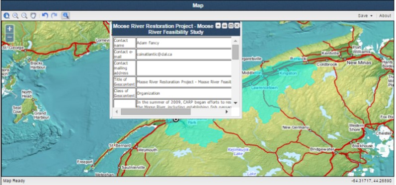
The CGG is a web-based tool for capturing basic metadata on an organization, project, publication or data set, links it to a spatial entity (i.e. polygon, line, or point), creates a KML file and facilitates its discovery on the internet by the Google search engine. The new version replaces the sequential process with a tab based interface that allows the user to easily move back and forth through the steps. It also makes more prominent the spatial entity capture step with the map always visible in the interface.
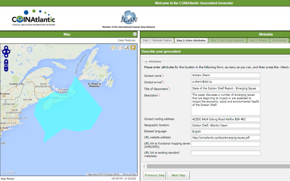
Other enhancements include the capability of entering a specific latitude and longitude coordinate as the spatial entity and uploading photographs to be included in the KML file. The CGG was designed to provide small organizations with a capability of making their data and information more visible on the internet. The CGG works together with the COINAtlantic Search Utility (CSU) that searches the internet for WMS and KML spatial data resources, including the KML’s built with the CGG and displays these resources on an interactive map. The CGG is available at http://www.marinebiodiversity.ca/coin/cgg/ and the CSU at http://www.marinebiodiversity.ca/coin/csu/