
OceanWise has delivered to MEDIN (Marine Environmental Data & Information Network) a pilot study showcasing the ability to link wreck features across multiple discrete datasets and publish resultant information via the internet. The study aimed to utilise data from MEDIN DAC's (Data Archive Centres) which was then ingested to a relational database or data-mart before publishing both the original datasets and the linked datasets via OGC compliant web services. Datasets were linked where foreign key identifiers were present to match duplicate features and represent the links spatially.
A focus was placed on delivering the functionality using easily accessible OpenSource software and tools and ensuring that good data management practices were upheld throughout. This meant that data would be stored once using an OpenSource relational database and utilised within the project through various “views” or virtualised layers. Not only does this minimise the data storage overhead but also results in the process to update the entire project consisting of loading one update file per source dataset (two in total).
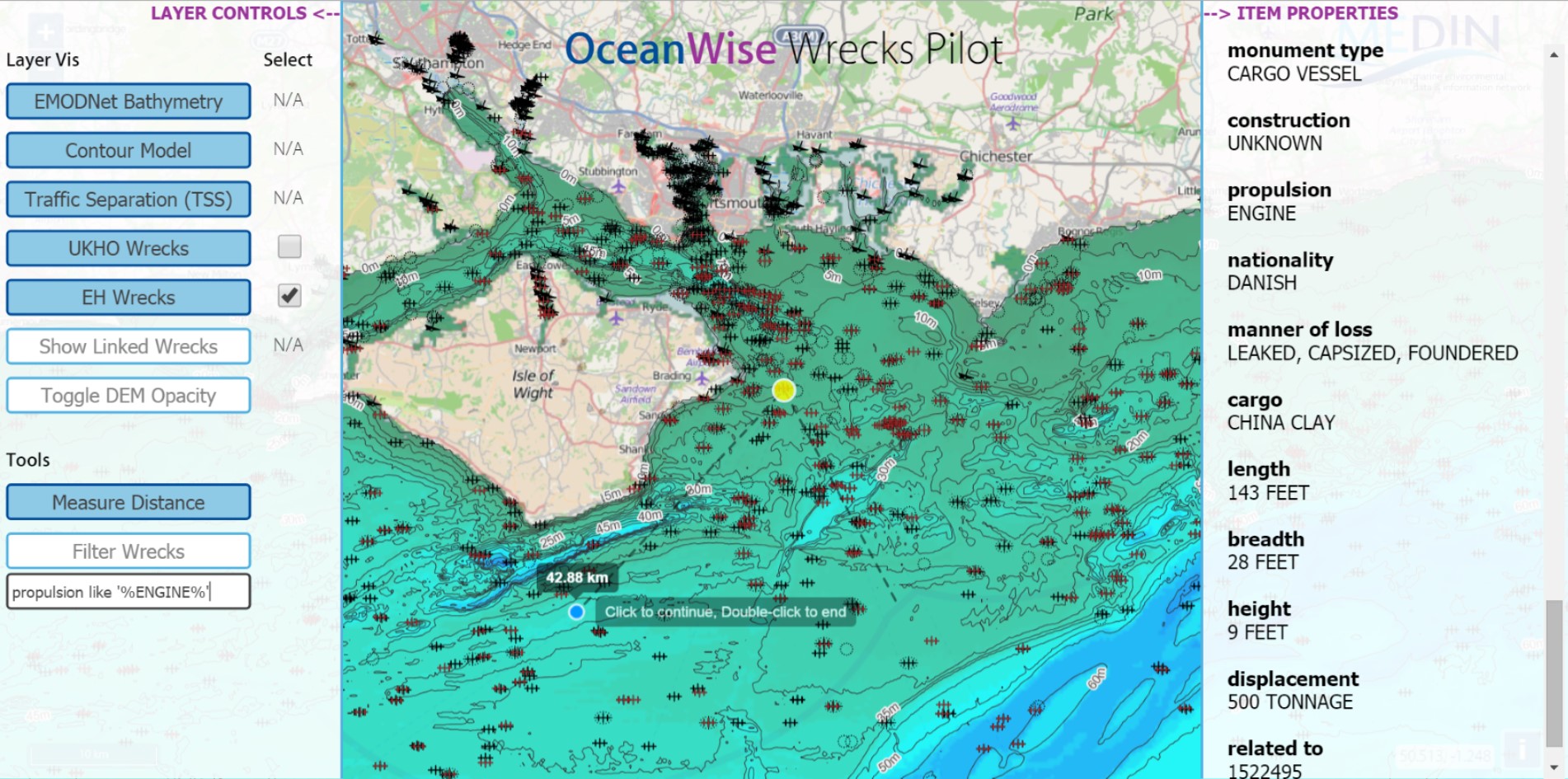
The web service layers were tested independently against a typical EIA (Environmental Impact Assessment) use case scenario by MarineSpace. For this, OceanWise produced a web map application that allowed basic analysis and view functionalities. For detailed analysis, WMS and WFS services were supplied that could be consumed by a standard desktop GIS. The benefit of visualising the join between matched features in different datasets through a spatial context can be seen immediately and is even more powerful when the user is able to combine the layers with their own thematic and base mapping information.
A detailed report was produced that explained objectives and methodologies in full. It also made recommendations to DAC's regarding the way datasets are structured and supplied and to OceanWise regarding the provision of the web services and web application offerings. Although there has been significant progress already made to create linked identifiers to be able to join duplicate features, there is still work to be done to address issues in the uncertainty of the spatial location of wreck features across different datasets. This is something that the linked map display helps to visualise and quantify.
The report will be published by MEDIN in the near future and points towards improvements where spatial data provided by MEDIN DACs can be accessed conveniently by specialists and non-specialists and used within a variety of platforms with ease.