
Choosing and Engaging with Citizen Generated Data
- Details
- Published: 15 January 2021 15 January 2021
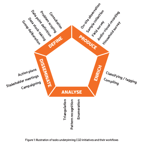
The Global Partnership for Sustainable Development Data, Open Knowledge International and Public Data Lab have published a guide for Citizen Generated Data (CDG) for use by governments, international organizations and others interested in developing, engaging with and supporting CGD initiatives.
The guide describes six (6) steps:
- Define the goals and scope of the initiative.
- Clarify what CGD approach is useful for your the Global Partnership for Sustainable Development Data purpose.
- Clarify how the participation of people will help,
- What resources are available to support CGD.
- Making Citizen Generated Data public.
- Consider risks, responsible data use and protection.
The guide also has suggested further reading, links to existing CGD tools and a list of over 200 CGD initiatives.
Choosing and engaging with citizen-generated data: A guide
 Download the guide in ENGLISH or ESPAÑOL